7:00AM FORECAST — Freezing start to Ash Wednesday. Risk for severe thunderstorms this evening. Here’s the details:
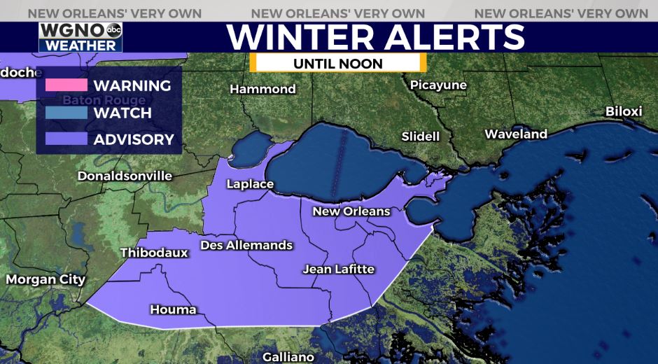
WINTER WEATHER ADVISORY — Issued for the Metro New Orleans until noon. Reports of minor icing of elevated roadways. Sleet and freezing drizzle possible with accumulations near 0.01-.1 possible. Temps will warm above freezing by mid morning, which will end any wintry precip.
Major travel issues this morning,. I-10 EAST closed at Elysian due to vehicle fire. Traffic diverted to Poydras. Crescent City Connection major delays due to several accidents.
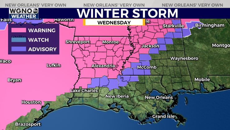
The winter that keeps on giving…another Winter Storm Warning issued for Northwest Louisiana. Unfortunately, this storm will bring freezing rain & sleet to places just impacted by Monday’s winter storm.

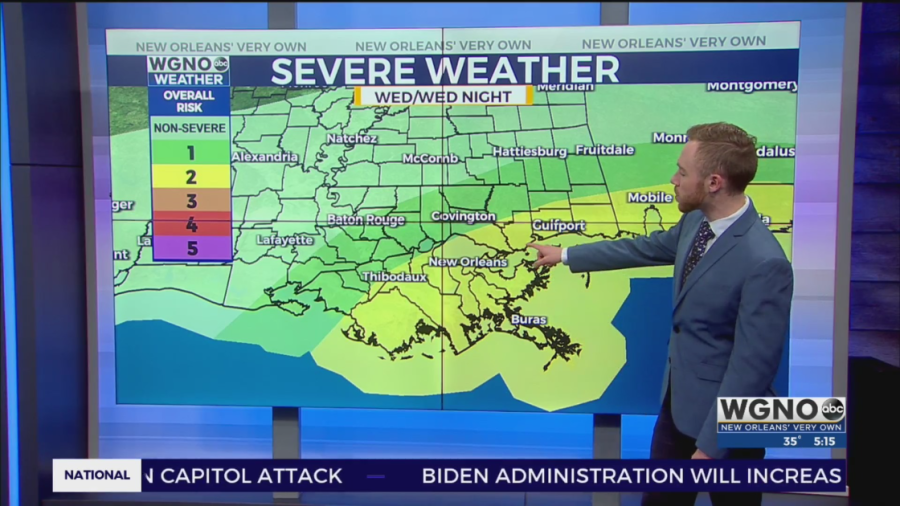
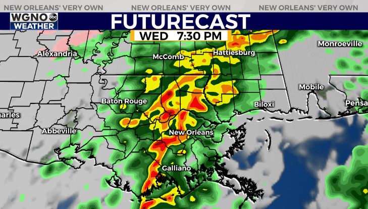
Meanwhile in southeast Louisiana within the “warm sector” of this approaching winter storm, we’re monitoring a severe weather threat late today into early tonight.
A Slight Risk(Level 2 out of 5) for severe thunderstorms. Main risk of damaging winds 45-60mph, large hail, & few isolated tornadoes. Timeframe for greatest severe risk looks to be between 5PM-9PM from west to east.
The key lacking ingredient for severe weather will be instability(heat & humidity) as temperatures will only rebound into the upper 50s/near 60 near New Orleans.
Behind the severe risk, much colder air will return. Another moderate to hard freeze expected north of the lake Thursday & Friday nights.