7:00AM VIDEO FORECAST from Meteorologist Scot Pilie – Cool, stunning Wednesday-Thursday. Severe potential late Friday-early Saturday. Here’s the details:
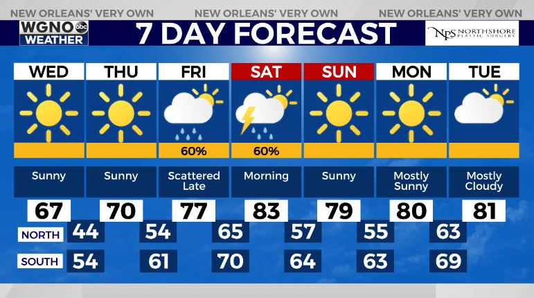
Lots of sunshine on the way Wednesday-Thursday along with below average temperatures Wednesday-Thursday.
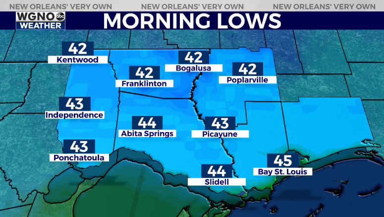
Low temperatures will be quite cool/chilly for this time of year with low-mid 40s on the Northshore and upper 40s-low 50s on the southshore.

Unfortunately, another severe weather risk looks to develop late week into the start of the weekend.

The Storm Prediction Center has introduced a Slight Risk(Level 2 out of 5) for severe thunderstorms Friday-Saturday.
Two rounds of storms possible, round one of scattered storms with the warm front late Friday & second round late Friday night-Saturday morning. All forms of severe weather appear possible including gusty winds, isolated tornado.
Based on latest model guidance, it appears the heaviest rain will stay north of southeast Louisiana with the greatest severe risk north of I-10/I-12. In fact, the best ingredients for any severe potential looks to be north of the LA/MS border.
The good news? Much of the rain looks to clear by mid-late morning with a mostly dry weekend!
For now, enjoy the lovely weather! Stay tuned as we iron out the details as we get closer to the weekend.


