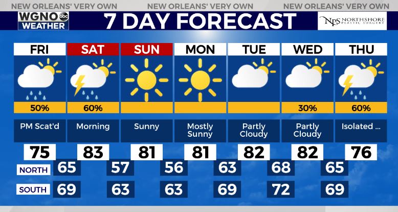
7:00AM VIDEO FORECAST — Clouds increasing! Severe weather potential late Friday-early Saturday. Here’s the breakdown:
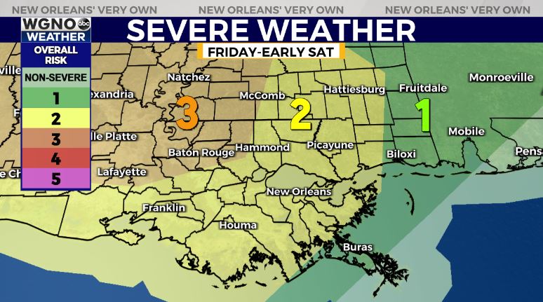
⚠UPDATE⚠ — For my Acadiana/south-central Louisiana folks, the Storm Prediction Center has upgraded the severe risk to an Enhanced(Level 3 out of 5) risk Friday-early Saturday. Main risk of damaging winds & few large hail reports. Isolated tornado potential.
For southeast Louisiana, a Slight(Level 2 out of 5) for a few strong to severe storms late Friday into Saturday mid day. The greatest severe risk looks to be north/west of the lake.
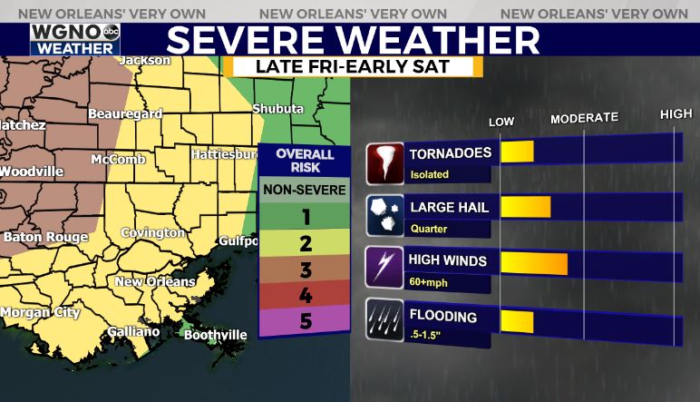
Main risk of gusty winds, isolated large hail report.
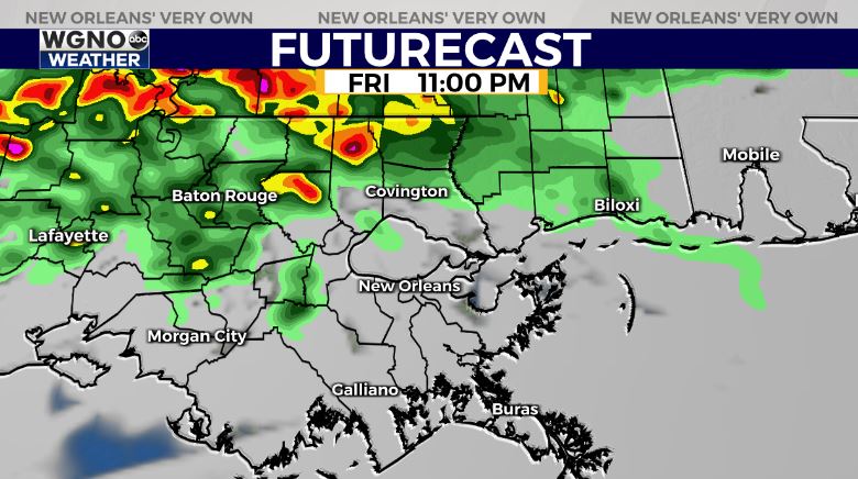
Timing: A few strong storms possible late Friday evening after sunset along the warm front, with mpre scattered storms possible Saturday morning-mid day.
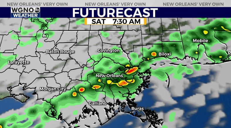
The good news? Spotty downpour possible through Saturday mid-day into early afternoon. Overall, not a washout! Drier air will spill in late Saturday-Sunday!