Happy Sunday as a stunning day today continues across southeast Louisiana. Indeed, the most gorgeous forecast for this first official weekend of spring!
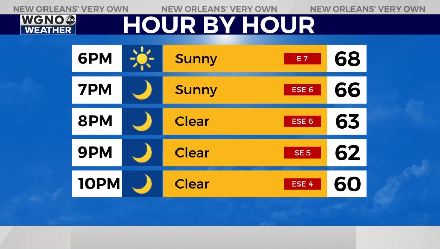
It’s tough to stay inside in these gorgeous conditions with sunshine galore. Highs by your afternoon after lunch are reaching the upper 60s to lower 70s area-wide.
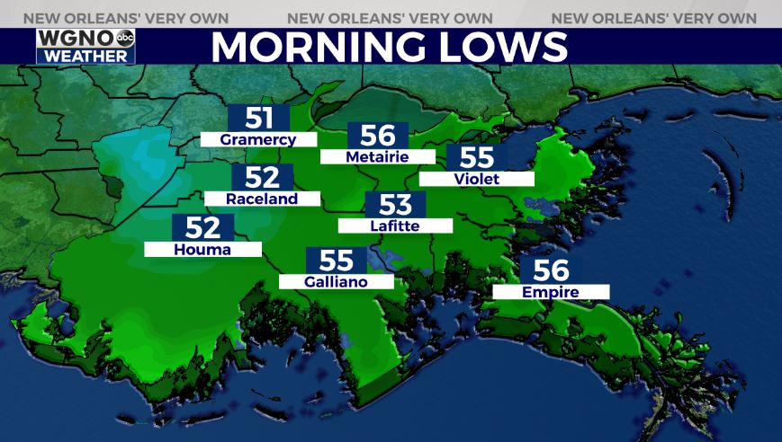
Anticipate an overall pleasant night tonight, as well. We should be similar to 24 hours ago since temperatures remain in 40s north of Lake Pontchartrain and 50s south.

Tomorrow, more clouds return as the theme continues being warmth. A pattern change will be beginning shortly as rain chances return each and every afternoon on radar.
This week, we must keep an eye on the forecast for Tuesday until Thursday as severe weather becomes a possibility. Simply not the best forecast for mid-week.

I anticipate an impressive 3-7 inches in many spots with localized higher amounts possible, which could lead to some flooding. Of course this is something we’ll be watching closely, so stay tuned!
Keep up, updates remain available online on WGNO.com all night tonight during WGNO News at 5 and 10!
Check out current conditions near you: https://digital-stage.wgno.com/weather/new-orleans-weather-radar/
Stay up to date with the latest forecast: digital-stage.wgno.com/weather/forecast/
Download the WGNO Weather App to stay connected this hurricane season