
Rain chances will increase over the next few hours especially north of the I-10 corridor. Look for showers and storms to develop and move north. The movement of these should help to prevent flooding issues although they could contain locally heavy rain.

It also looks like these will be intensifying as they move north into Mississippi. Hail and gusty winds will be possible across the Florida parishes with the stronger cells before they move out.
After that we will see one more round of storms with the front Thursday afternoon.
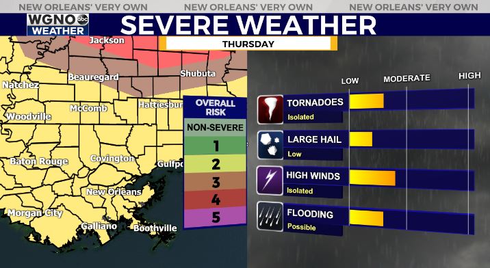
Like last week the greater potential for severe weather will be to our north. However we still have the level 2 risk over our area so an isolated severe storm will be possible. Stay alert to the conditions Thursday.
Also like last week it will be very windy ahead of the front. We have a wind advisory in effect for the area from Thursday at 9AM to 6PM.
We will see a drier day on Friday.