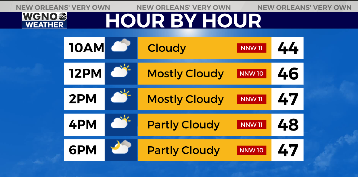
Temperatures are chilly Thursday afternoon across much of the area with low to mid 50s for southeast Louisiana and southern Mississippi and 40s for the central and northern parts of the states.
The storm system that brought rain last night continues to move off to the east wrapping around cloud cover as it does so.
Strong winds are also wrapping around the backside of the low pressure area.
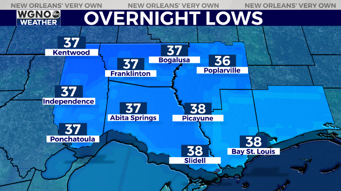
Temperatures Friday will struggle to get to 50 across the area, followed by upper 20s to low 30s for a light freeze to the north Saturday morning with mid 30s south.
Cold air sticks around through the middle of next week.
Check out current conditions near you: https://digital-stage.wgno.com/weather/new-orleans-weather-radar/
Stay up to date with the latest forecast: digital-stage.wgno.com/weather/forecast/
Download the WGNO Weather App to stay connected this hurricane season


