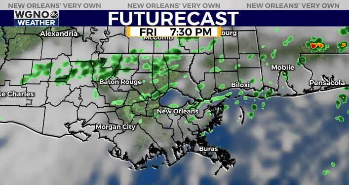
A cold front will move through the area tonight bringing lower rain chances with it. This front will not push all the way out of the area though so we are going to be stuck with quite a bit of cloud cover the next few days.
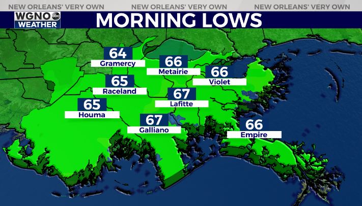
Tonight temperatures will be a little bit cooler overall with mainly low to mid 60s up to the north.
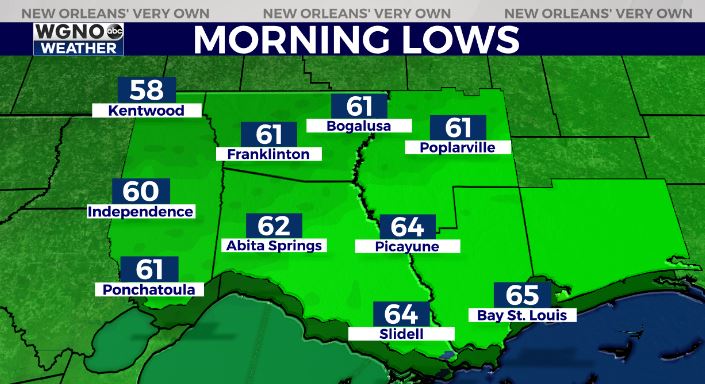
On the south shore look for mid to upper 60s by Friday morning. Fog will be likely over the area water through the night and some of that could move inland by sunrise.
After that the front just lingers in the region with another one on the way by Sunday. So rain chances will not be that high but we could still see a few spotty showers both Friday and Saturday afternoons.
Look for a better chance of rain on Sunday followed by a cooler and drier day on Monday.
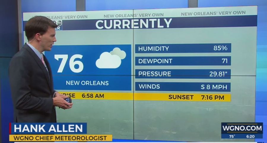
Check out current conditions near you: digital-stage.wgno.com/weather/maps-and-radar/
Stay up to date with the latest forecast: digital-stage.wgno.com/weather/forecast/
Download the WGNO Weather App to stay connected this hurricane season