6:30AM VIDEO FORECAST — Grab the umbrella! Wintry mischief possible Lundi Gras for parts of Louisiana, including areas north-west of I-12. We will have to monitor the forecast closely.

First things first, Friday morning is looking soggy. Expect localized heavy downpours, especially south of the lake. Rain coverage looks to remain spotty into the evening with light showers.
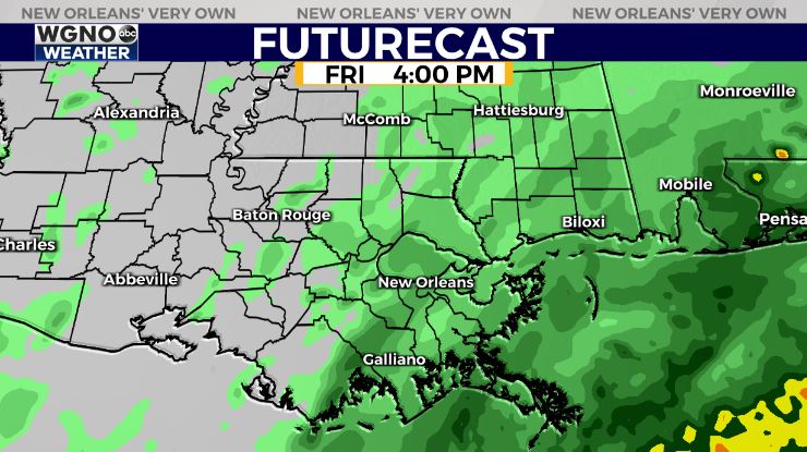
Similar story Saturday with intermittent light showers possible. Not a washout, but a good idea to have an indoor backup plan!
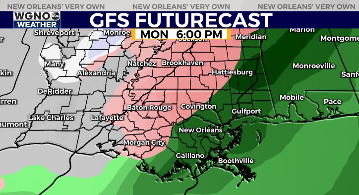
Alright, let’s talk WINTRY MISCHIEF — The coldest air looks to hold off until late Lundi Gras-Fat Tuesday. We will have to monitor potential for a hard freeze, especially north of the lake. Potentially the coldest Mardi Gras since 2011 when the high temp was 42 in New Orleans.
Right now, forecasted lows on Tuesday morning of 19-25 on the Northshore would mean full precautions of pipes, pets, plants, and people. Southshore of 27-32 would also mean light faucet drip for the pipes, especially away from the lake.
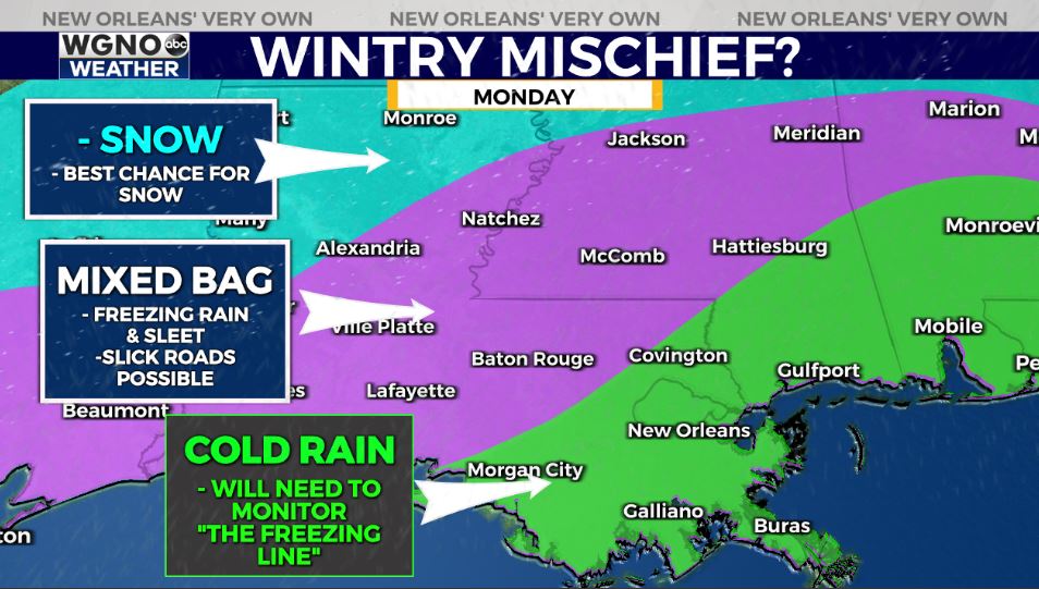
As far as wintry mischief, we look a little too warm for wintry mischief here on the southshore of southeast Louisiana, but for areas north and west of the lake…a period of sleet/freezing rain may be possible. This does not look like a snow setup. Slick roads could make for treacherous travel Lundi Gras evening-Fat Tuesday morning.
For the southshore, we will need to monitor the location of the freezing line.
It’s certainly worth watching the pattern into Lundi Gras-Fat Tuesday as things become more clear, especially in southeast Texas/northwest Louisiana. Stay tuned!


