Cold weather will continue through the weekend with the chance for freezing rain increasing for parts of the area on Monday. Rain chances through the weekend look small with a few spotty showers this evening and then a slight chance on Sunday afternoon.
We are also going to stay above freezing through Monday morning even though it will feel cold.
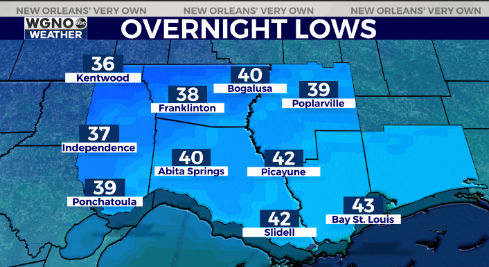
Look for mid to upper 30s to around 40 tonight up north with low to mid 40s south. It’s the afternoon temperatures that will stay cold and not warm up much.
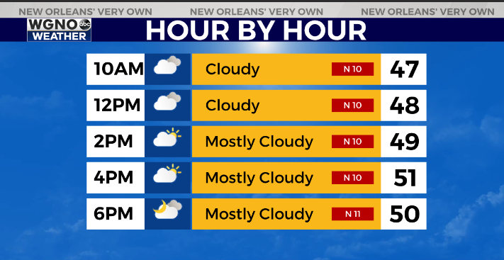
Tomorrow will be another day where temperatures struggle to reach 50 across the area. North shore areas will likely stay in the 40s. Some coastal showers will be possible early Saturday but otherwise we will stay dry.
Going in to Monday there are still some issues with timing in terms of cold air and precipitation. However it looks like at least the western side of the area could get freezing rain. Accumulations will be possible farther northwest and could lead to dangerous travel on area roads.
Any moisture left on the roads will also likely freeze Monday night as temperatures drop well below freezing Tuesday morning. Continue to follow along through the weekend.

.
Check out current conditions near you: digital-stage.wgno.com/weather/maps-and-radar/
Stay up to date with the latest forecast: digital-stage.wgno.com/weather/forecast/
Download the WGNO Weather App to stay connected this hurricane season


