New Orleans’ forecast for Sunday night looks dry and muggy. Today we were dealing with above normal temperatures, and warmth remain the theme until late week!
Single word that sums up upcoming weather patterns: LAYERS!
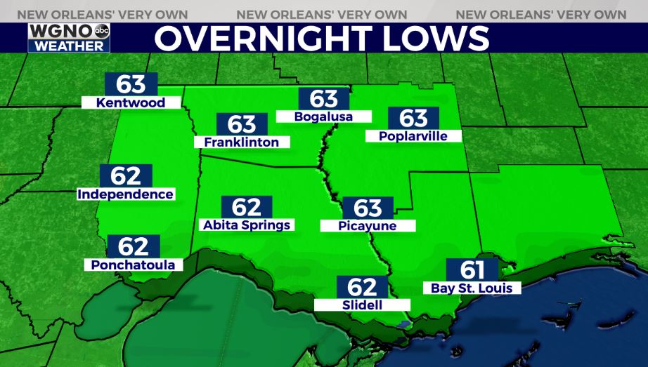
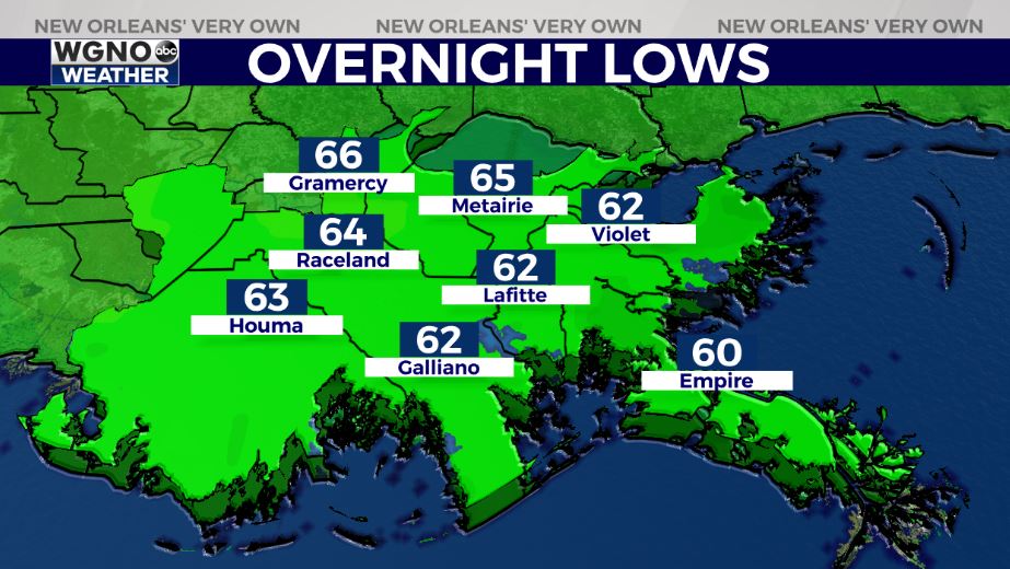
Northshore residents wake up tomorrow to lower 60s outside their windows, however, Southshore residents can expect upper 60s! Highs reach 70s by your afternoon after lunch.
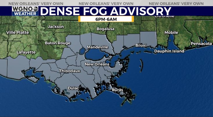
Again, fog will be becoming widespread once more tonight until Monday, so a Dense Fog Advisory remains in effect from 6 PM – 6 AM across the Louisiana, Mississippi Gulf Coast.
Front 1 of 2 arrives Monday then stalls, meaning rain chances go up at that point. Southeast Louisiana’s outlook tomorrow to mid-week includes shower chances.
Wednesday, we see front 2 of 2 clear our area. Anticipate a low end, if any, severe weather threat as few strong thunderstorms look probable. This is something we’ll be watching closely incase details change regarding timing, intensity, etcetera!
Takeaway: Confirmation on beautiful conditions next weekend! Keep up, updates will be accessible online on WGNO.com and through our WGNO Weather App! Happy Sunday!
Check out current conditions near you: https://digital-stage.wgno.com/weather/new-orleans-weather-radar/
Stay up to date with the latest forecast: digital-stage.wgno.com/weather/forecast/
Download the WGNO Weather App to stay connected this hurricane season