Watch out for patchy fog again later tonight and early Thursday as warm moist air continues to move back into the area.
This along with cooler ground and water temperatures could set the stage for areas of dense fog by later tonight. Otherwise lows will be dropping into the low to mid 50s tomorrow morning.
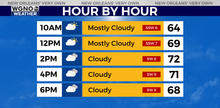
Temperatures will be back into the low 70s Thursday afternoon with a southwest breeze. Overall more clouds tomorrow and in general we will see quite a bit of cloud cover through the middle of next week. Not much sun over the next few days.
It still looks like rain chances will move into the northern areas north of I-12 by later tomorrow evening and sag southward by Friday. Look for scattered showers Friday and Saturday with cooler conditions Saturday as well.
The system will lift back north Sunday for a warmer end to the weekend.
Check out current conditions near you: https://digital-stage.wgno.com/weather/new-orleans-weather-radar/
Stay up to date with the latest forecast: digital-stage.wgno.com/weather/forecast/
Download the WGNO Weather App to stay connected this hurricane season


