Temperatures are mostly in the 40s this evening with some areas that saw cloud cover through the day only making it into the low 40s this afternoon. Otherwise clearing around the area has allowed temperatures to drop quickly.
Another cold night is on the way although like last night some clouds may hold numbers up a bit. Skies have cleared across most of the area this afternoon but already some cloud cover is trying to move back in from the southwest.
We will look for temperatures to drop to right around freezing up to the north by Wednesday morning.
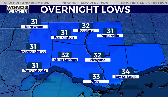
Look for mid to upper 30s on the south shore. As usual though if clouds move in a bit thicker we could stay above freezing. However just to be safe it’s a good idea to keep any sensitive plants covered.
Otherwise we do warm up over the next couple of days. Look for mid to upper 50s Wednesday with low to mid 60s on Thursday.
Check out current conditions near you: https://digital-stage.wgno.com/weather/new-orleans-weather-radar/
Stay up to date with the latest forecast: digital-stage.wgno.com/weather/forecast/
Download the WGNO Weather App to stay connected this hurricane season


