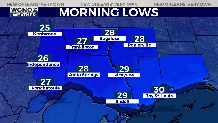
Yet another cold day today after a record-setting forecast for Lundi Gras into Mardi Gras! We have two more nights of freezing conditions, then the warm up finally returns!
Anticipate an incredibly cloudy, overcast sky all night tonight as temperatures plummet again in both Northshore and Southshore locations.
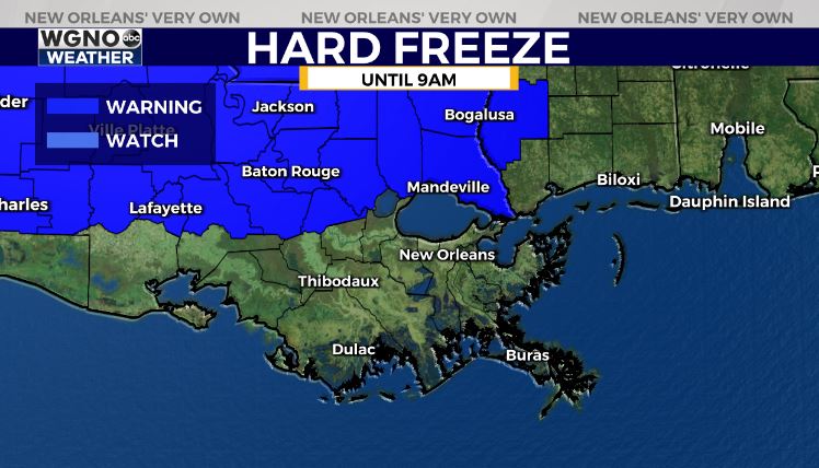
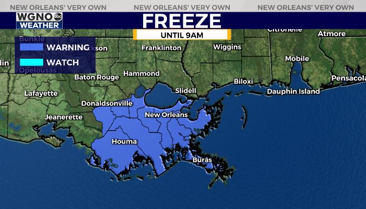
Our local National Weather Service is issuing Hard Freeze as well as Freeze Warnings until Friday at 9AM based off of frigid overnight temperatures.

A Hard Freeze Warning is issued north of Lake Ponchartrain in areas needing to protect all four Ps: people, pets, plants, pipes! Anytime lows fall below 28 degrees for several hours at a time, property or vegetation can become damaged, so be intentional in wrapping any exposed outdoor elements.
A Freeze Warning is issued south of Lake Ponchartrain in areas needing to protect just three Ps: people, pets, and plants! Most parishes will be below the freezing mark but above 20s, so pipes shouldn’t face any problems. If they are wrapped, already, though, leaving preparations in place won’t hurt.
Good news: Precipitation on roadways will no longer be an issue, plus sunshine returns Friday, so at that point, it will feel warmer outside! The 70s are even in our forecast for next week! Hang in there, New Orleans!
Keep up, updates remain available online on WGNO.com always! More details in my forecast for WGNO News at 5 P.M., 6 P.M., and 10 P.M.! Stay warm!
Check out current conditions near you: https://digital-stage.wgno.com/weather/new-orleans-weather-radar/
Stay up to date with the latest forecast: digital-stage.wgno.com/weather/forecast/
Download the WGNO Weather App to stay connected this hurricane season