It will be a chilly but good night to check out the first full moon of the year! Temperatures are beginning to drop this evening with low to mid 50s and will drop quickly once the sun goes down.
We still have some high level cloud cover around the area which may prevent them from dropping all the way by tomorrow morning.
Expect less wind tonight though and with the dry air and cold air mass temperatures will approach freezing in the northern half.
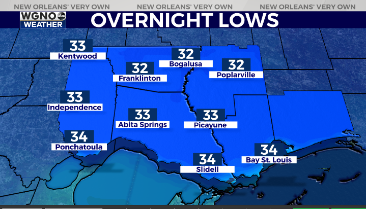
This will be a light freeze but if you have plants that could be damaged around freezing it’s a good idea to cover them up.
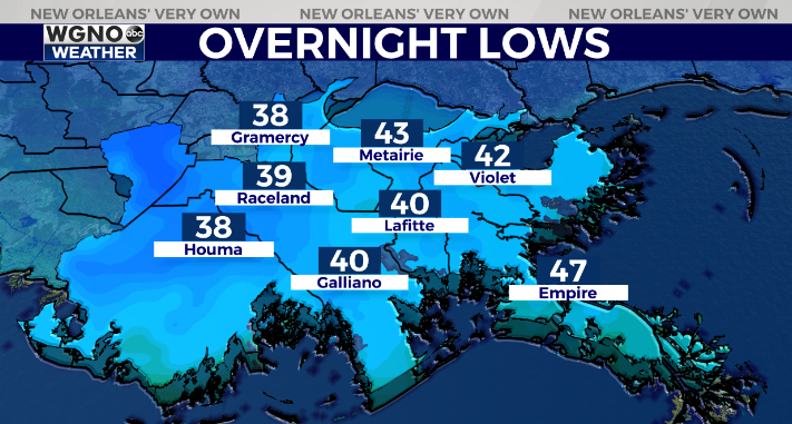
Temperatures on the south shore will drop into the upper 30s to low 40s with the colder spots more inland from the marine areas.
Another cool day is on the way for Friday with highs topping out around 60. After that temperatures climb back to near 70 on Saturday.
Check out current conditions near you: digital-stage.wgno.com/weather/maps-and-radar/
Stay up to date with the latest forecast: digital-stage.wgno.com/weather/forecast/
Download the WGNO Weather App to stay connected this hurricane season


