5:30AM VIDEO FORECAST — Stormy Spring Setup. Localized heavy rain & severe weather risk. Here’s the details:
After a quiet & lovely Monday, we’re monitoring another threat for flash flooding & severe weather Tuesday and into Wednesday, with rain continuing into Thursday.
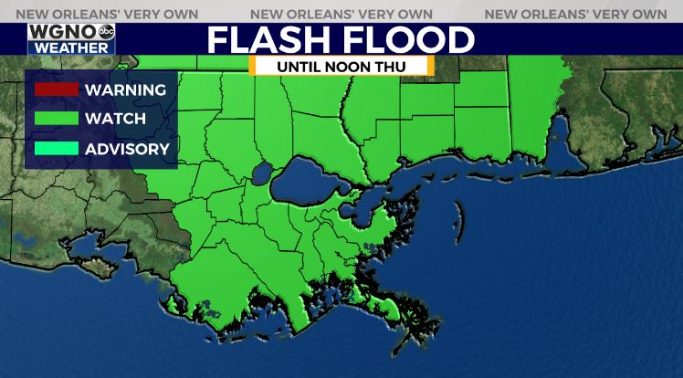
A Flash Flood Watch has been issued until noon Thursday for all of southeast Louisiana and South Mississippi ahead of the anticipated heavy rainfall.
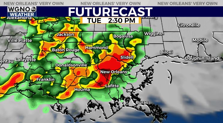
Stalled frontal boundary will provide sufficient lift for thunderstorm development starting Tuesday mid day.
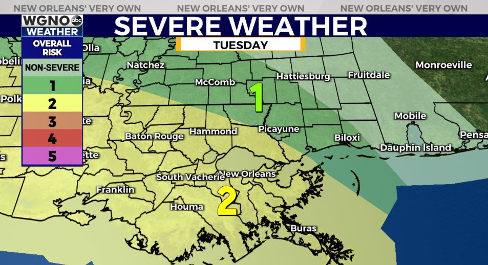
The Storm Prediction Center has upgraded much of south Louisiana to a Slight Risk(Level 2 out of 5) for severe thunderstorms.
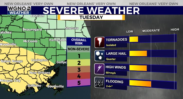
Primary risk of large hail, gusty winds, and locally heavy rainfall. Isolated tornado potential, but low-end risk.
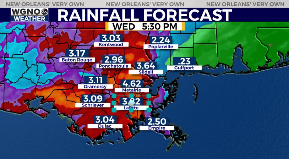
Localized heavy rainfall of 2-4″ appears likely, with localized hot spots of 3-6+” possible between Tuesday-Wednesday. Some hot spots of higher amounts will be possible if/where thunderstorms train.
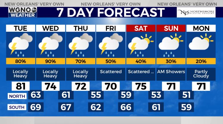
Rain chances still look to remain in the forecast into Friday-Saturday, although the rain coverage looks more scattered rather than numerous. Late Saturday-Sunday looks like the best days of the week!


