5:30AM VIDEO FORECAST from Meteorologist Scot Pilie — Spotty rain today. Severe threat ramps up late tonight-Saturday morning. Please have a way to receive weather alerts. Here’s the breakdown:
A complex 24 hours ahead as a strong spring storm system rolls across the Gulf South.
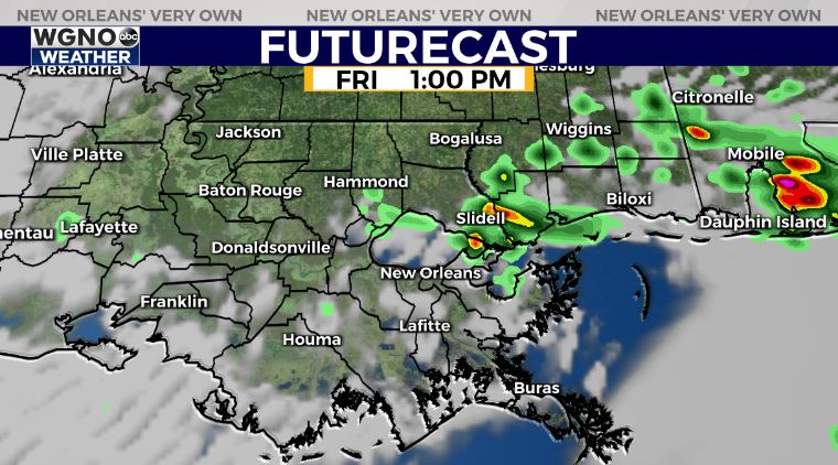
Today, expect a spotty strong storm or two. Rain coverage at 40%, so rain will not be widespread. A few localized heavy downpours possible. Main risk of any storms that develop will be hail.
This system looks to bring a widespread potential for severe weather across a large section of the Gulf Coast.
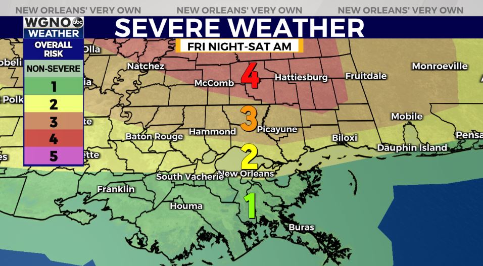
A Moderate Risk(Level 4 out of 5) for severe thunderstorms has been placed for a large section of south/central Mississippi. Damaging winds of 60-70mph, large hail, and several tornadoes possible.
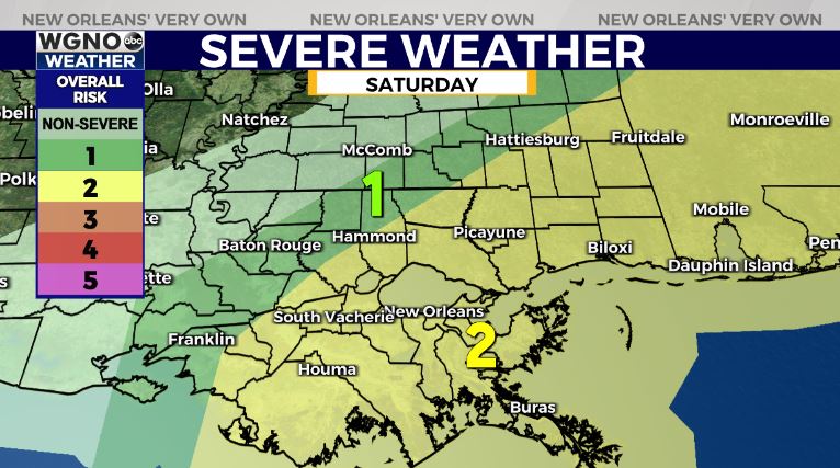
An Enhanced Risk(Level 3 out of 5) has been placed for much of the Northshore & a Slight Risk(Level 2 out of 5) for much of the southshore & Metro New Orleans.
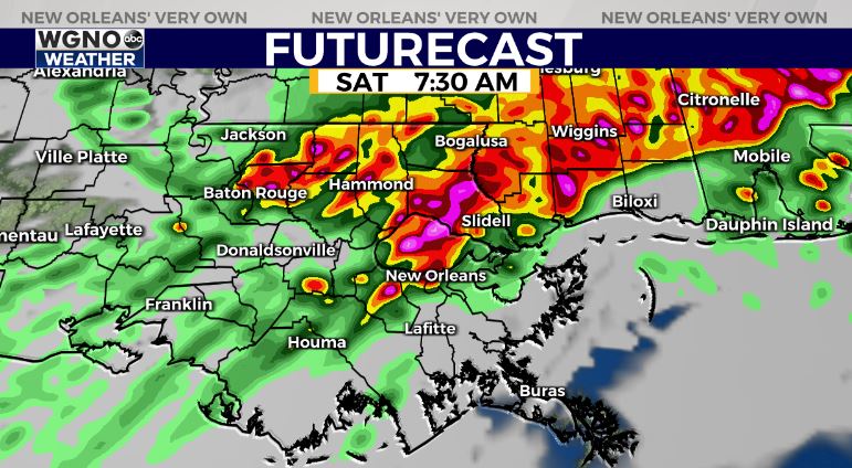
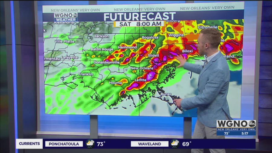
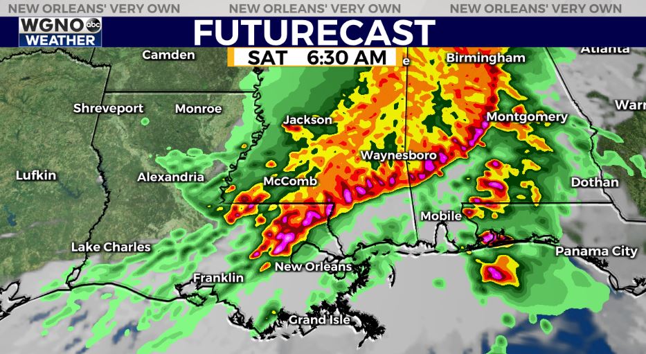
The primary timeframe for severe storms looks to be between 3:30AM-9:30AM on Saturday morning from northwest to southeast across the area.
The good news? Rain chances become much more spotty into Saturday afternoon! An much of Sunday is looking dry across the area!

Weather pattern looks to stay active into next week…