5:30AM VIDEO FORECAST — Heads up! Heavy rain & flash flood risk Tuesday-Thursday. Here’s the breakdown:
Stormy pattern on the way Tuesday-Thursday across the Gulf South.
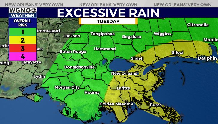
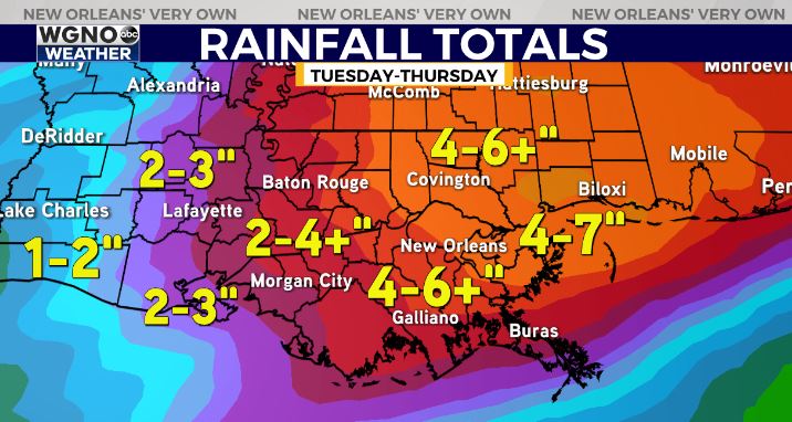
Potential for heavy rain & flash flood risk. 2-4” of rainfall appears likely with localized 4-7+” of rainfall possible. Localized higher amounts possible.
In addition, a low-end Marginal Risk(Level 1 out of 5) for a few strong thunderstorms. Main risk of gusty winds, hail, & isolated tornado risk.
Take the time today while the weather is nice to clean your storm drains, catch basins, & secure loose items!
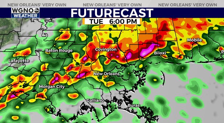
Timeframe appears tricky with intermittent periods of rainfall possible starting Tuesday morning. The flash flood risk looks to ramp up late Tuesday-Tuesday night through Wednesday night.
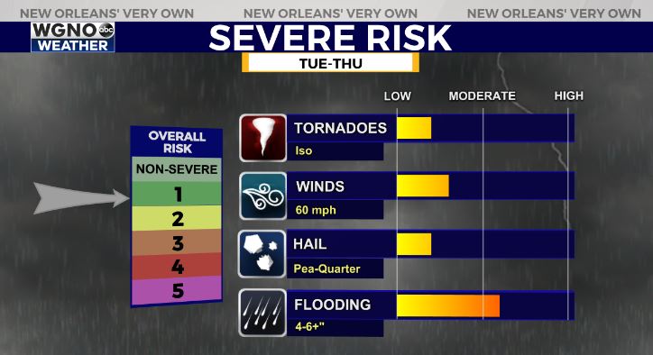
By Thursday, forecast models diverge on the details. Some models showcase the rain risk & severe risk staying further north. Still giving a 50-60% chance of thunderstorms, with a Slight Risk(Level 2 out of 5) risk for severe weather as well. Main risk of gusty winds & isolated tornado threat.
Stay tuned as we get closer!


