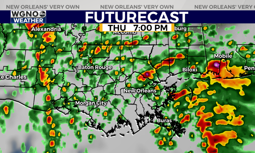
Severe storms will be possible in southeast Louisiana and southern Mississippi to close out 2020 but the threat around midnight looks lower than it has the past couple of days. Right now the main time frame of severe potential appears to be 6-10 PM as isolated cells develop and move north.
At the moment we are not seeing much activity around the area. The warm front has lifted farther north around I-20. Most of the area is in the more unstable airmass south of the warm front although overall lift is still out to the west.
The forecast model here shows a burst of isolated cells this evening after sunset.

This looks to be our best chance of severe weather since the main line out to the west appears it will weaken as it moves in.
The main threat looks to be north of I-10. In this setup isolated cells that are strong enough will have the chance to tap into the ingredients in the atmosphere to produce damaging winds or potentially tornadoes.
By midnight though most of the stronger weather looks gone so if you are planning to set off some fireworks you should have an opportunity.
As always stick with WGNO through the night and have a way to get warnings if they are issued.
Check out current conditions near you: https://digital-stage.wgno.com/weather/new-orleans-weather-radar/
Stay up to date with the latest forecast: digital-stage.wgno.com/weather/forecast/
Download the WGNO Weather App to stay connected this hurricane season


