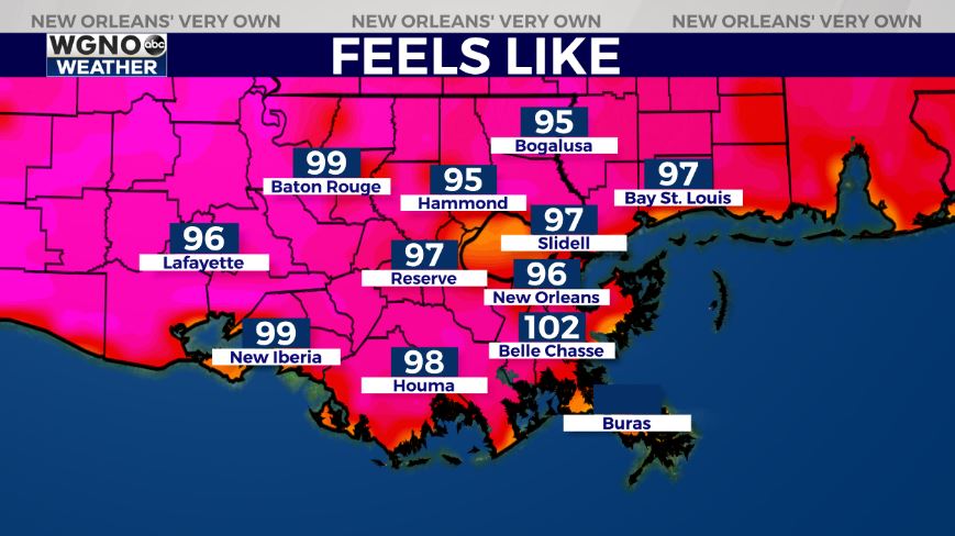
Once again, the forecast for today across New Orleans and southeast Louisiana is hot and humid with near record-tying temperatures and sunshine.
Afternoon highs are, area-wide, reaching the mid 90s. Once the humidity factors, in, however, it feels like the triple digits across much of southeast Louisiana. A Heat Advisory remains in effect until 7PM, so drink plenty of water and stay inside in air conditioning whenever possible.
Overnight, over both Northshore and Southshore locations, expect 70s on both sides of Lake Pontchartrain! Late tonight we’ll see clearing before rain chances return much of this week. At that point, scattered activity cannot be ruled out with each day presenting about a 30% or 40% threat of showers through your upcoming week. Of course, this is going to mean temperatures rise into mostly low 90s! Typical forecasts for June!
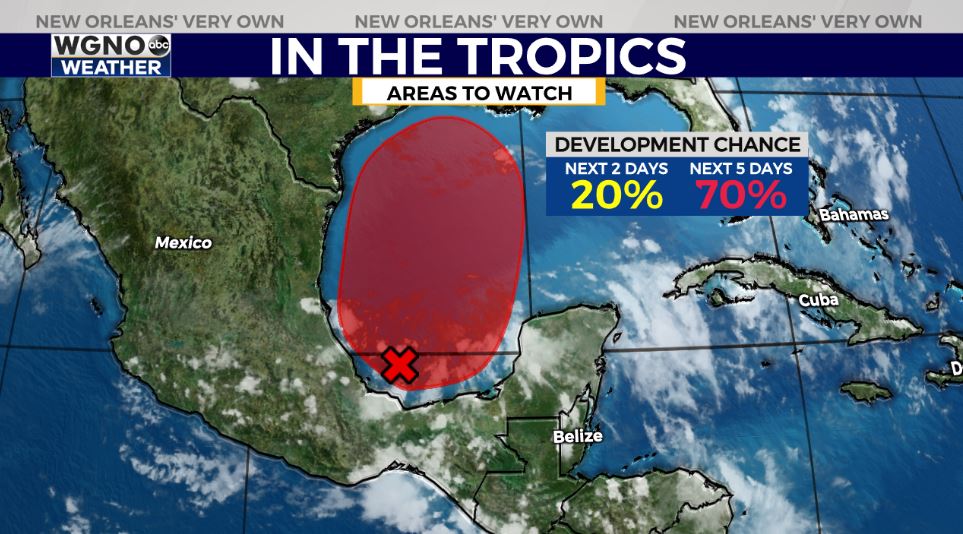
Right now, no immediate concerns amid open waters! These next 48 hours look calm as far as potential tropical development, but there is about a 20% chance for formation of this materializing low pressure system in the Bay of Campeche by early next week and a 70% chance by mid-week. We can keep a close eye on it, of course, but there’s no reason on being concerned yet!
Soak up these gradually warming temperatures while they last and keep up as more information in WGNO.com articles plus each newscast will be available the whole day today. Catch us live during Good Morning New Orleans!