
Finally, we are drying out across much of southeast Louisiana after rain in our region has ended. Round two is within the forecast for Thursday.
Still, a Flash Flood Watch is issued from right now until midnight Friday across southeast Louisiana due to the growing likelihood impressive totals could still fall over these next two days.
Anticipate an increasing Slight Risk (Level 2 out of 5) for severe thunderstorms as your afternoon progresses. Damaging winds (45-60 mph), large hail, and isolated tornadoes are a possibility. Timeframe will span late morning through afternoon after lunch.
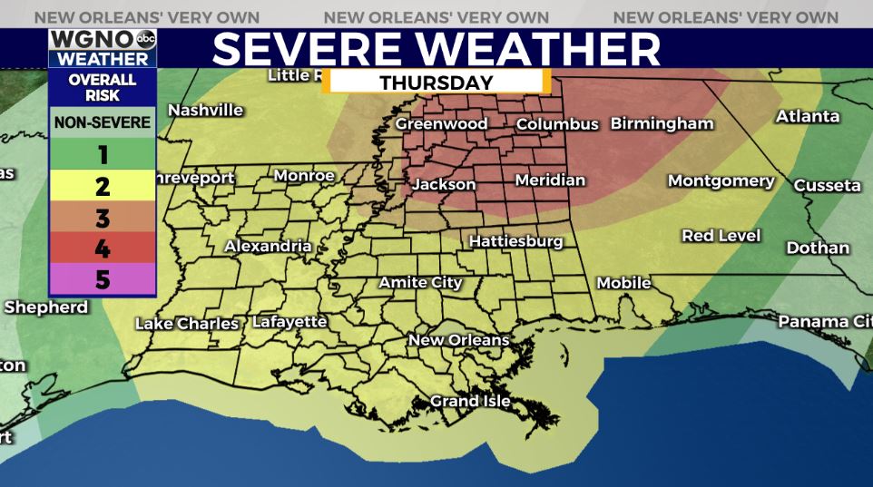
Right now, greatest threats are area-wide concerns across Central as well as Northern Mississippi plus Alabama. If your children attend Mississippi State University, Ole Miss, Alabama, or any other college within this Moderate Risk (Level 4 out of 5) area, be sure they know this is coming.
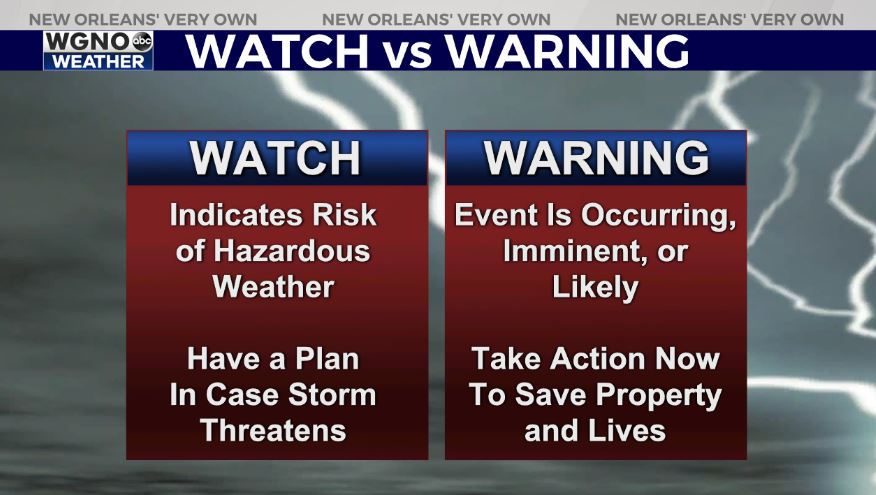
Make sure you have a way to receive watch or warning information on hand incase anything is issued. Behind the severe risk, cooler air will return again in your weekend outlook.
Stay weather aware to keep up as updates remain available online on WGNO.com continually and on air during WGNO News at 5, 6, and 10 tonight plus Good Morning New Orleans tomorrow.
Check out current conditions near you: https://digital-stage.wgno.com/weather/new-orleans-weather-radar/
Stay up to date with the latest forecast: digital-stage.wgno.com/weather/forecast/
Download the WGNO Weather App to stay connected this hurricane season


