
Happy March as a spring-like pattern sets up with our next front moving through now!
Rain chances accompany the system tonight to early Tuesday, so grab your umbrella if heading out!
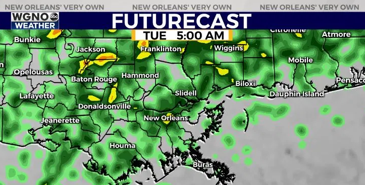
There’s the chance isolated flooding could become possible with total accumulation on streets between .5”-1.0” across some local spots.
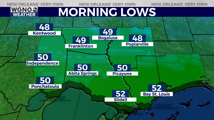
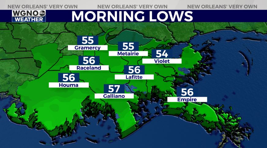
Everyone wakes up tomorrow to 40s or 50s on the Northshore and 50s on the Southshore! Highs reach upper 50s to lower 60s by your afternoon after lunch with more storms.
Cooler air will be behind this with less humidity and 60s in your forecast for mid-week. We see a reinforcing front push through, Friday, meaning showers return at that point.
Keep up, updates remain available online on WGNO.com and during WGNO News at 5, 6, and 10!
Check out current conditions near you: https://digital-stage.wgno.com/weather/new-orleans-weather-radar/
Stay up to date with the latest forecast: digital-stage.wgno.com/weather/forecast/
Download the WGNO Weather App to stay connected this hurricane season


