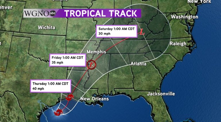
NEW ORLEANS – Tropical Storm Harvey continues to crawl to the east in the Gulf of Mexico, dumping heavy rains and causing flash flooding in Texas and Louisiana.
As of the latest advisory, Harvey had maximum sustained winds if 45 mph and is moving to the east at 3 mph. Harvey will continue to make a slow turn to the north today and eventually make a second landfall just inside the Louisiana side of the Louisiana/Texas border late Wednesday or early Thursday. By Thursday, Harvey will finally begin to quickly move out of the area and be racing through the Ohio River Valley by the weekend.
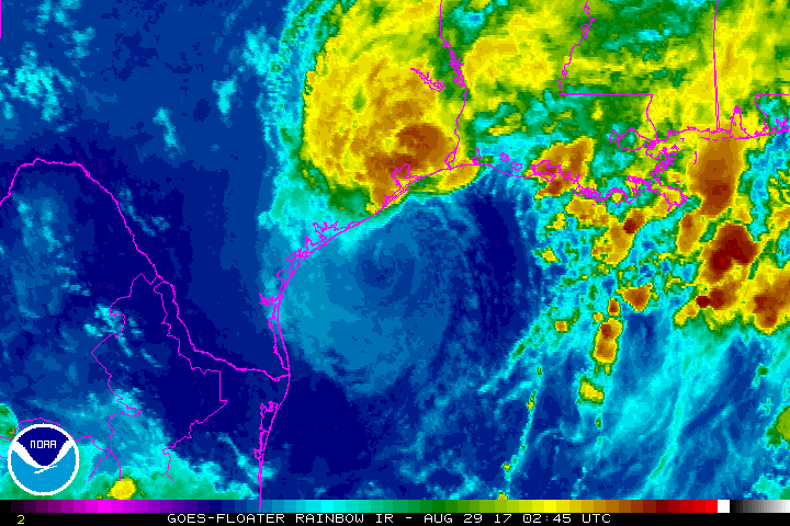
Looking at the satellite imagery this morning, a dry slot has become more embedded in the eastern side of the circulation. This dry slot is currently offering some relief to Lake Charles, which had already seen rain amounts up to 20″ on Monday. As the storm moves east, so will the dry slot and it may offer a slight chance at relief for our area.
Make no mistake, even though the dry slot may work it’s way into our area, the threat for flash flooding still remains for Southeastern Louisiana!
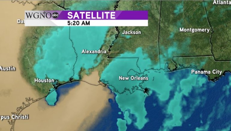
Widespread rain amounts of 5-8″ or rain are possible across the area with isolated amounts over 10″. To the east in coastal Mississippi, even higher amounts are possible as the dry slot does not appear that it will move far enough east to affect folks from Waveland to Mobile.
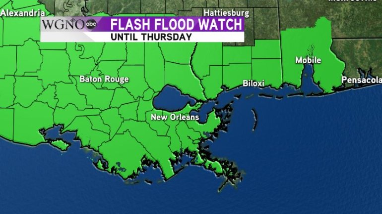
The ground across the area is already saturated and as more heavy rains roll through, the potential for flash flooding will continue. Because of this, the National Weather Service has issued a flash flood watch for the entire area through Thursday. If you come to a flooded roadway, turn around and find another route.
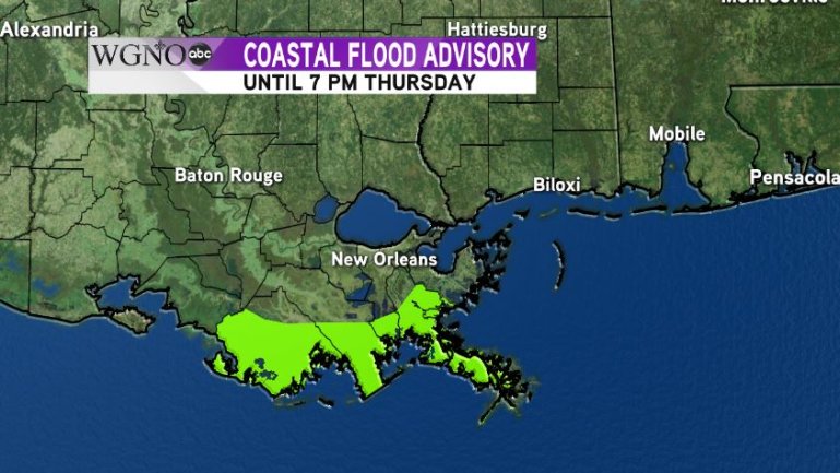
In addition to the flooding threat from the rain, there is also the threat of flooding along the Gulf coast from higher than average tides. An onshore flow has set up and southerly winds of 20-30 mph will cause tides to be 1-2 feet higher than normal through Thursday. A coastal flood advisory is in effect until Thursday for the coasts of Terrebonne, Lafourche, Jefferson and Plaquemines Parishes.
We will continue to monitor Tropical Storm Harvey and its effects on our area and will post regular updates as we monitor the situation.