
What a difference 24 hours makes since yesterday we were dealing with sunshine and 60s! Today, instead, the themes are humity plus rain chances!
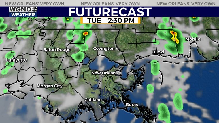
These showers will stick around through late afternoon. After 5PM or so, we’ll be beginning to see rain ending with clouds lingering behind. This is because Sunday’s cold front lifted north as a warm front, bringing highs up to upper 70s, low 80s.
Another cold front returns late Wednesday, hence storms will ramp up at that point.
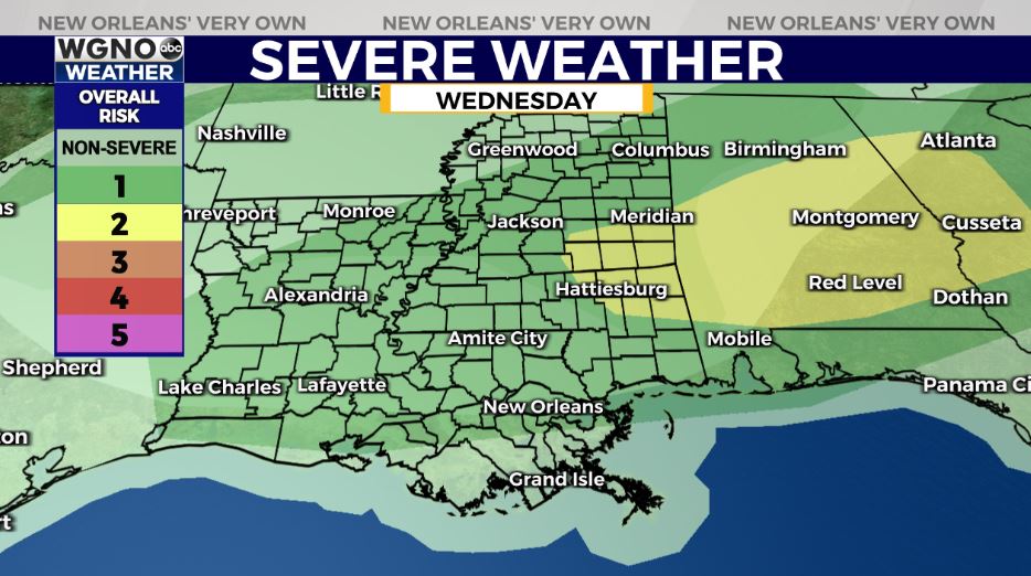
Right now, the Storm Prediction Center is issuing a Marginal Risk (level 1 out of 5) for severe thunderstorms. This is a low end threat, but gusty winds and a possible spin up tornado cannot be ruled out completely.
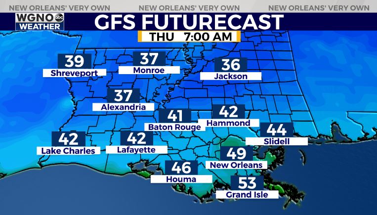
We have spring-like patterns sticking around with the forecast for Easter weekend looking much quieter. At that point, it will feel like it did Monday with cold overnight lows dipping into the upper 30s and lower 40s.
Keep up, updates remain available online on WGNO.com and during WGNO News at 5, 6, and 10!
Check out current conditions near you: https://digital-stage.wgno.com/weather/new-orleans-weather-radar/
Stay up to date with the latest forecast: digital-stage.wgno.com/weather/forecast/
Download the WGNO Weather App to stay connected this hurricane season