
Well, we are certainly ending February on a high note after quite the rollercoaster of weather this month.
Another stunning day today across New Orleans and southeast Louisiana as conditions are warmer than we were these past couple of afternoons, reaching even 80s! This is near record warmth!

Warmth remains the theme until another front arrives Monday! Single word that sums up upcoming weather patterns: LAYERS!
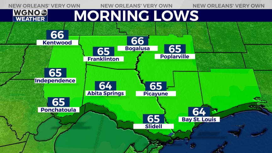
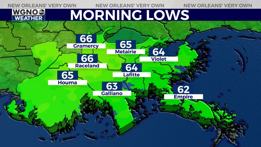
Everyone wakes up tomorrow to 60s on both sides of Lake Pontchartain! Highs reach upper 70s to lower 80s by your afternoon after lunch.
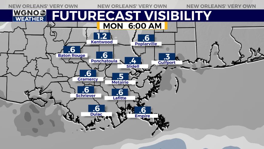
Dense fog will be becoming an issue overnight tonight to early Monday once again. Maintain caution on the roads, and remember your low beams will be best. A Dense Fog Advisory will likely expand to include our area.
Another system arrives late Monday, so rain chances go up at that point. Most of this is going to be concentrated toward later evening hours, and showers or storms will be below severe limits.
Keep up, updates remain available online on WGNO.com and during WGNO News at 5 and 10 Sunday night! Happy weekend!
Check out current conditions near you: https://digital-stage.wgno.com/weather/new-orleans-weather-radar/
Stay up to date with the latest forecast: digital-stage.wgno.com/weather/forecast/
Download the WGNO Weather App to stay connected this hurricane season


