
A heavy band of rain continues to sit across southeast Louisiana and offshore from coastal Mississippi. This band has almost come to a stop over the past hour, and locally heavy rain will persist within it.
The heaviest rainfall rates should remain just south of I-10 over the next 2-3 hours including along and south of the highway 90 corridor. Expect areas of street flooding to continue in the metro New Orleans area and also areas south of the city.
Parking restrictions on neutral grounds have been lifted, so move vehicles off of streets!
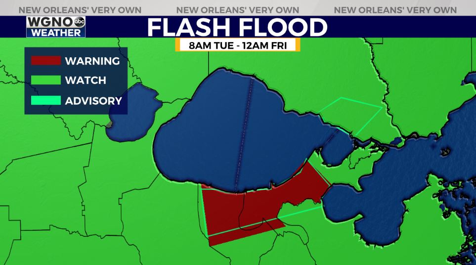
A Flash Flood Warning is issued across Jefferson and Orleans Parishes until 4:15PM Tuesday plus St. Bernard Parish until 4:30PM Tuesday. If possible, stay off of the roads to avoid traveling with low visibilities and gathering standing water. Parking restrictions on neutral grounds have been lifted, so move vehicles off of streets!
A Flash Flood Watch is issued, as well, from right now until midnight Friday across southeast Louisiana due to the growing likelihood 4-8 inches in total could fall over these next three days. The Weather Prediction Center is issuing a Slight Risk (level 2/5) for excessive rainfall across our New Orleans metro and portions of Mississippi’s Gulf Coast.

Keep up, updates remain available online on WGNO.com all night tonight during WGNO News at 5, 6, and 10!
Check out current conditions near you: https://digital-stage.wgno.com/weather/new-orleans-weather-radar/
Stay up to date with the latest forecast: digital-stage.wgno.com/weather/forecast/
Download the WGNO Weather App to stay connected this hurricane season


