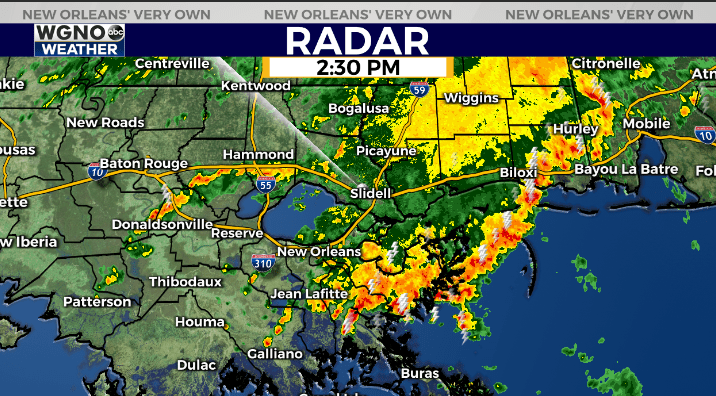
Heaviest rain Thursday afternoon is pushing east of the immediate New Orleans area through Plaquemines and St. Bernard. However there are still areas of rain with locally heavy downpours behind this larger batch and that trend will continue through early evening.
After that activity should taper off heading in to tonight.
The cold front is currently moving in to the area.
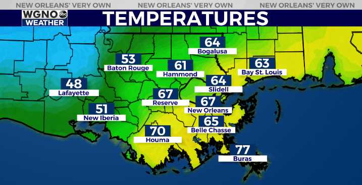
Temperatures are still in the mid 70s ahead of the front but only in the upper 40s and low 50s behind it. While we do cool down over the next couple of days the coldest air will stay farther to the west. So overall temperatures will remain just slightly below normal for Friday and Saturday afternoons with upper 50s to low 60s.
Look for lows in the mid to upper 40s tonight and Friday morning.
After that another round of rain looks to move through the area late tonight and early Friday. The Futurecast shows this during the Friday morning commute.
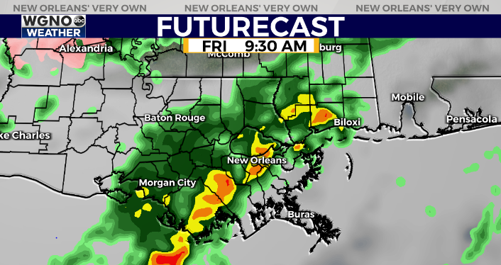
After that wave moves through a few showers will still be possible through Friday night and early Saturday but in general rain chances will be much lower through the weekend.
Check out current conditions near you: https://digital-stage.wgno.com/weather/new-orleans-weather-radar/
Stay up to date with the latest forecast: digital-stage.wgno.com/weather/forecast/
Download the WGNO Weather App to stay connected this hurricane season