Rain in the area has mostly ended after a cold front moved through earlier this afternoon on radar.
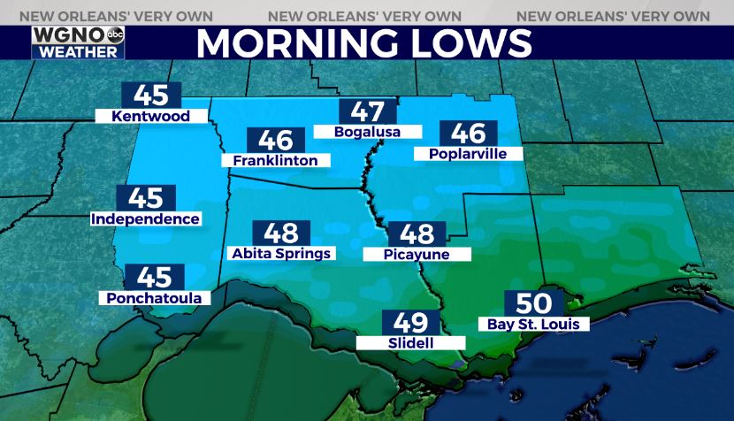
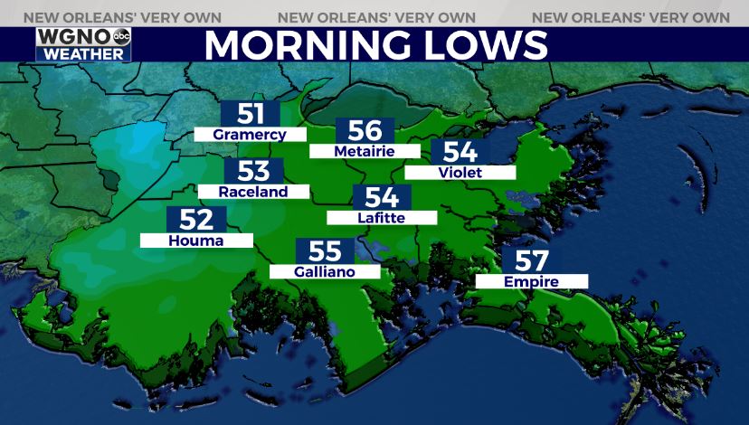
Highs by your afternoon after lunch reached the lower area-wide, but temperatures will be beginning to fall now. Anticipate an overall pleasant, chilly night tonight. Temperatures remain in 40s north of Lake Pontchartrain and 50s south.
Tomorrow, rain chances increase in your Monday outlook late. This is because today’s cold front lifts north as a warm front.
Another returns mid-week, so the storms will ramp up again in these next few days. We have spring-like patterns sticking around with the forecast for Easter weekend looking much quieter.
Keep up, updates remain available online on WGNO.com all night tonight during WGNO News at 5PM and 10PM!
Check out current conditions near you: https://digital-stage.wgno.com/weather/new-orleans-weather-radar/
Stay up to date with the latest forecast: digital-stage.wgno.com/weather/forecast/
Download the WGNO Weather App to stay connected this hurricane season


