Sally is now classified as a category one hurricane with 90 mile per hour wind speeds and must be watched closely while intensifying in the next 12-18 hours before landfall.
We are growing more concerned for a strengthening hurricane on approach to landfall in south Mississippi because this system is moving slower, and it still has 24 to 36 hours over water.
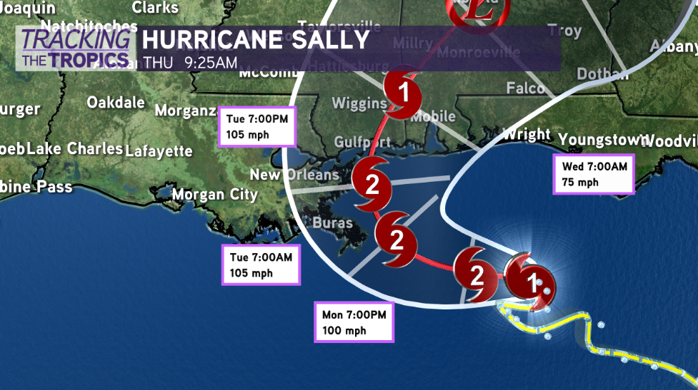
This being said, a category 2 hurricane looks far more likely, with the ceiling of intensity creeping higher due to slightly more eastern track shifts. Even a major hurricane is not off the table. Category 3, 4, and 5 hurricanes are classified as major hurricanes.
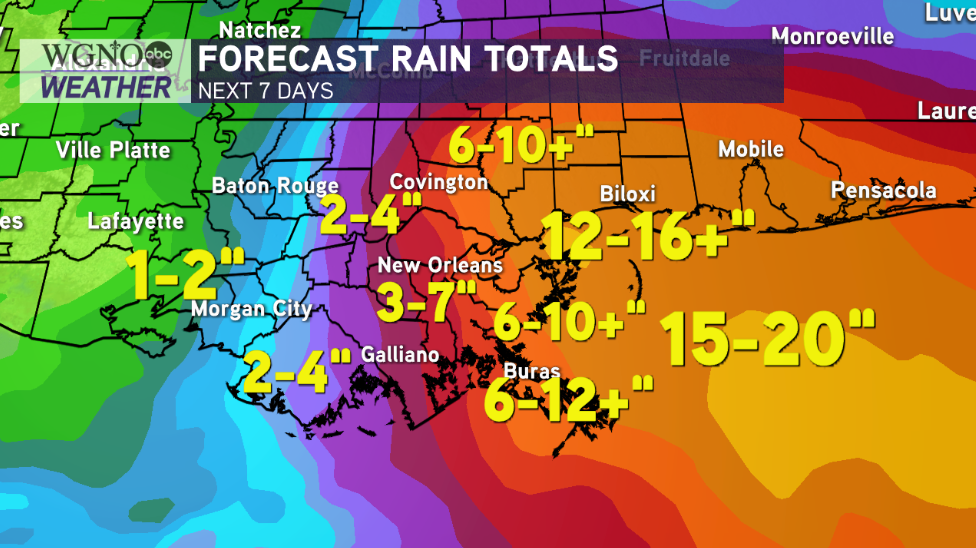
This is the breakdown. A slower, more east track means the system has more time over water to intensify. All residents from southeast Louisiana to the Alabama, Florida Panhandle should be prepared for significant impacts. Greatest impacts are trending lower for New Orleans Metro, though.
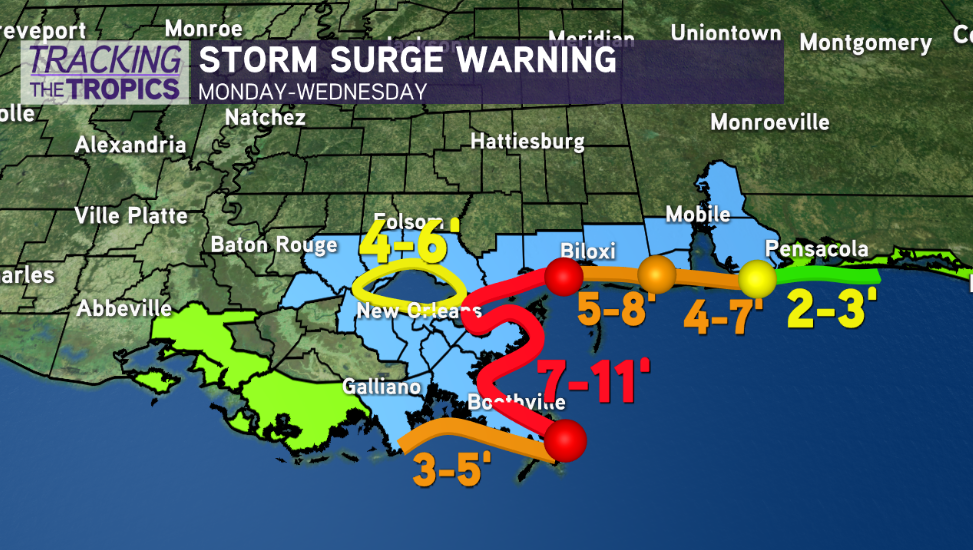
For coastal southeast Louisiana, significant coastal flooding between 7 and 11 feet is still expected from the mouth of the Mississippi River to Ocean Springs, Mississippi.
50 miles will make all the difference in impacts, especially for the New Orleans Metro. It is about as close of a call as you can get. Do not let your guard down.
50 miles further east would mean impacts in Louisiana will be FAR lower. 50 miles west, on the other hand, would mean much more significant impacts. It’s simply too early to call, but we are feeling more optimistic for the NOLA Metro. It will be a long 24 hours watching for potential wobbling west.
Prepare as if it’s coming, and hope for the impacts to miss!


