Drier air will continue to move in behind the cold front tonight and Thursday. Dewpoints will go from the mid 70s yesterday to the mid 50s over the next couple of days. This will mean very pleasant conditions at night and warm but dry afternoons.
The humidity will stay low through midday Saturday. This is going to be a really nice early spring feel with the cooler and drier conditions. That will also allow overnight lows to drop quite a bit the next couple of mornings.

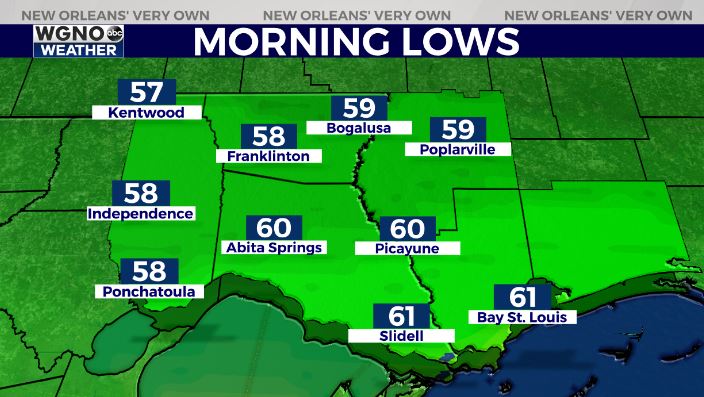
Look for upper 50s in the northern half to start the day Thursday. It will still be in the mid to upper 60s on the south shore.
Expect plenty of sun to wrap up the week with afternoon highs only around 80 both days. Saturday will be nice with low 80s and then we warm into the mid 80s for Mother’s Day.


