The first of a few waves of rain this week will be moving through the area Wednesday night and Thursday morning. Ahead of that expect a day similar to Tuesday with warm and breezy conditions. Look for low 80s with a few spotty showers Wednesday afternoon.
The main line of storms will be moving in just after midnight up along the I-55 corridor. This line will continue to move east across the entire area.

Look for locally heavy rain and lightning with this line. Gusty winds and small hail will also be possible.

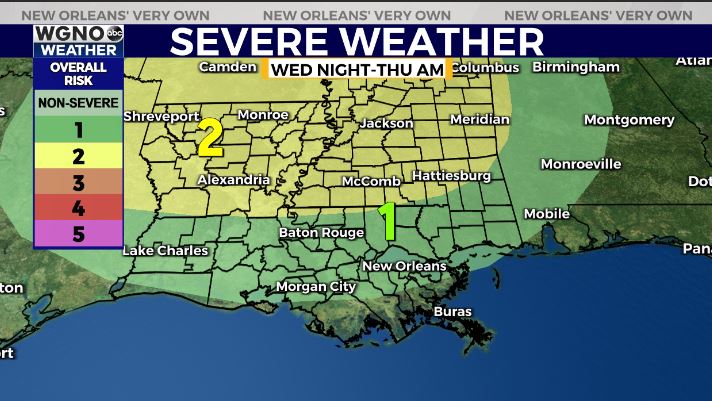
There is also a low end chance of severe weather with this system. Most likely the storms will remain just below severe limits but a warning or two will be possible. Since this will move in overnight make sure you have a way to get warnings if one is issued for your area.
Rain chances will continue Friday with a much more widespread and heavy batch coming in early on Saturday.


