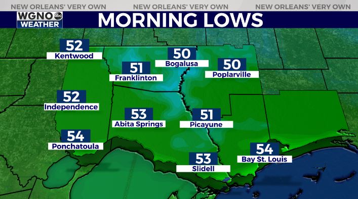
Temperatures will be cool early Friday thanks to dry air and mostly clear skies around the area. Look for lows in the low 50s north with mid to upper 50s south.
We will warm up quickly though into the mid 70s as southeast winds increase ahead of a storms system moving in from the west. That storms system will bring a round of storms with it by Friday evening as a warm front moves through.
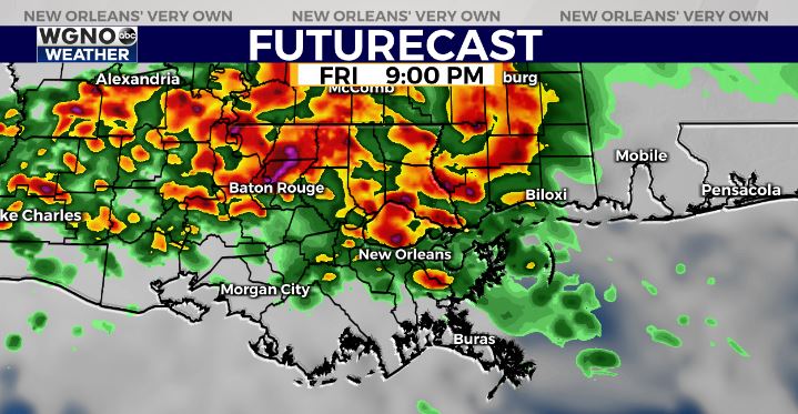
Some storms could be strong to severe with strong wind gusts and an isolated tornado. After that the big question is what do we see through the rest of Saturday morning.
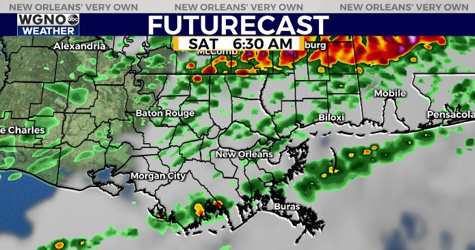
Some forecast models indicate a line of storms coming through the area. Others keep most of the activity farther to the northeast. Either way, be aware of the severe weather threat with any storms that develop and have a way to get warnings if they are issued.
We should dry out for the second half of the weekend on Sunday.
As always stay with WGNO on air and online for the latest.


