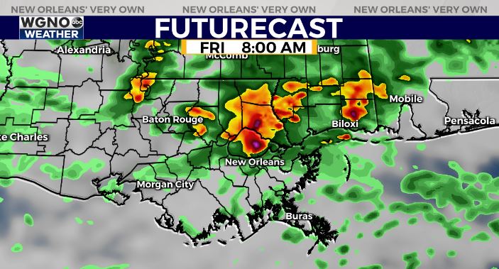
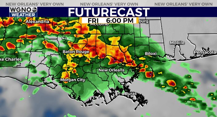
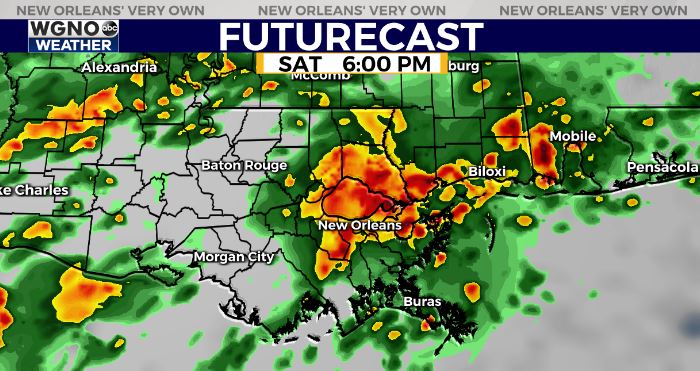
The threat of more heavy rain will continue as we head into the weekend. Several forecast models are point at multiple waves of rain over the next couple of days. The Futurecast below is showing a model that has been very reliable over the past few days.
It looks like we see a quick round of heavy rain tomorrow morning that will affect the north shore and along I-10.

After that a large area of heavy rain will develop and move through the area. Unlike the past few this will actually go from southwest to northeast and it looks like will lead to the heaviest rain totals along and north of I-12 through the evening.

The recent runs of models this evening also point to another batch of storms moving through sometime either Saturday afternoon or early that night. This would likely be as the main front is finally pushing through.

Needless to say the ground is saturated. Any additional heavy rain could lead to street flooding. The Flash Flood Watch has now been extended through Saturday.
As always stay with WGNO on air and online and download the WGNO news app.


