Temperatures are already up 30 degrees in some spots this morning after the sub-freezing start to the day in a few areas. We will continue into the mid 60s this afternoon. The sun and dry air should make for very pleasant conditions.
We will see one more chilly night thanks to the dry air and clear skies. In general lows will be in the upper 30s to around 40 to the north, although some spots may get down to the mid 30s briefly Tuesday morning.
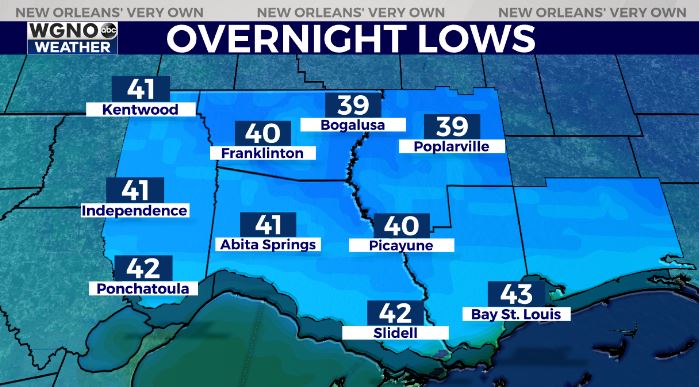
Look for lows to bottom out in the mid 40s to the south.

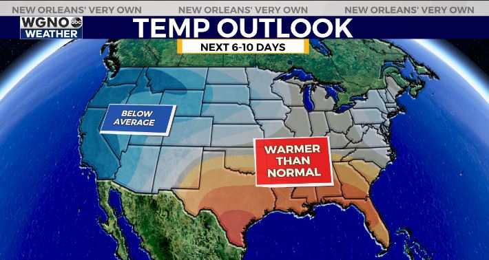
Overall the next week and a half will see warmer conditions. Temperatures will rebound to near 70 in the afternoon with 50s for lows.
The one exception could be on Saturday depending on the placement of a cold front this weekend. It looks like that front will linger near the area for a few days and could also produce some rain chances by late Thursday into Friday.
Check out current conditions near you: https://digital-stage.wgno.com/weather/new-orleans-weather-radar/
Stay up to date with the latest forecast: digital-stage.wgno.com/weather/forecast/
Download the WGNO Weather App to stay connected this hurricane season


