New Orleans’ forecast for early Friday morning includes rain in front of yet another low pressure system. Today, we were dealing with above normal, Spring-like temperatures, but chillier air comes back to town by your weekend.
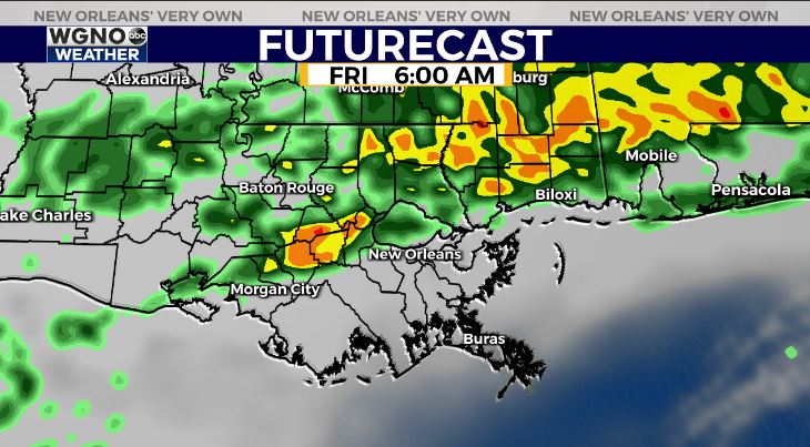
Around daybreak, rain chances will start to increase in parishes north of I-10/ along I-12.
On radar, expect our storm threat at or before 6 A.M. Right now, no severe elements are area-wide concerns.
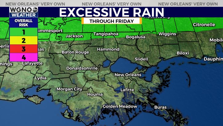
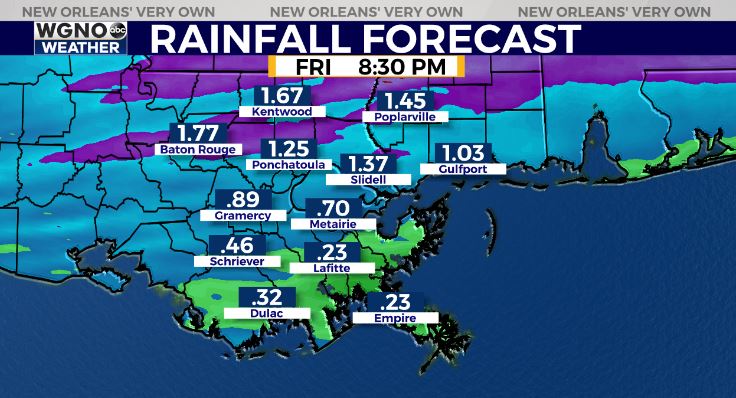
This is a Marginal Risk (Level 1 out of 4) for localized heavy rainfall across Northshore locations.
Anticipate an overall precipitation total between one and two inches beyond Lake Pontchartrain into south Mississippi.
Fog will also be becoming widespread, so add a few minutes to tomorrow morning’s commute as visibilities drop below single miles. Conditions improve after our system progresses east, then the cooler air filters through. At that point, highs reach upper 50s – low 60s!
Keep up, updates stay available during WGNO’s Good Morning New Orleans newscasts plus online on WGNO.com!
Check out current conditions near you: https://digital-stage.wgno.com/weather/new-orleans-weather-radar/
Stay up to date with the latest forecast: digital-stage.wgno.com/weather/forecast/
Download the WGNO Weather App to stay connected this hurricane season


