11:00AM VIDEO FORECAST from Meteorologist Scot Pilie — Flash flood watch continues. Hit/miss storms today & Thursday. Here’s the breakdown:
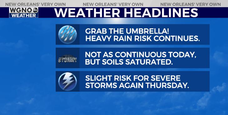
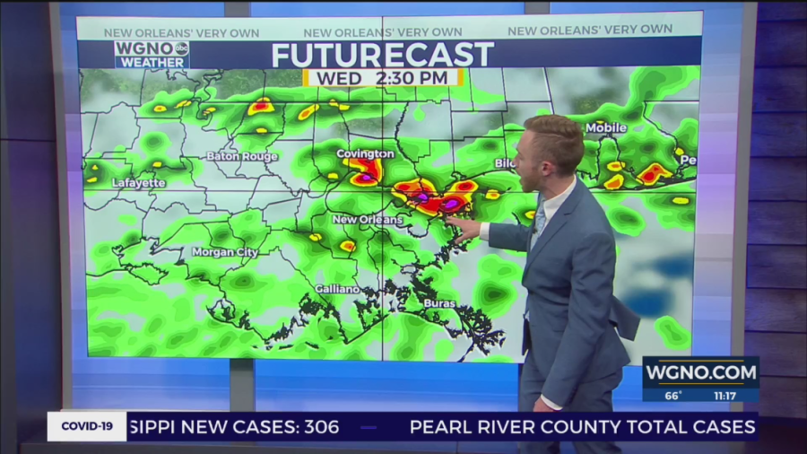
Today, expecting the heavy rain risk to continue. However, the rain doesn’t appear to be as non-stop and continuous as Tuesday. It will be more spotty/scattered.
With soils being saturated, any additional rain could exacerbate flash flooding issues. So continue to be aware!
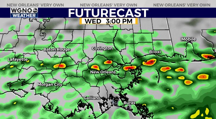
Scattered hit/miss heavy downpours expected throughout the day as the stationary boundary gradually lifts northward.

Thursday, the greatest severe risk looks to remain to our north. A Moderate Risk(Level 4 out of 5) for severe storms for north Mississippi/Alabama.
A Slight Risk(Level 2 out of 5) for severe storms in southeast Louisiana. Main risk of gusty winds & isolated tornado risk. Timing for SE Louisiana from 10AM-3PM Thursday.