11:00AM VIDEO FORECAST — Flash flood risk starting Tuesday. Clear storm drains & catch basins! Here’s the breakdown from Meteorologist Scot Pilie:

Growing more concerned with the flash flood potential over the next few days, specifically Tuesday as slow moving round of storms appears likely. Please clear catch basins & storm drains today!
Here’s the latest HRRR for Tuesday evening showing potential “training” of thunderstorms across parts of SE Louisiana/S Mississippi.
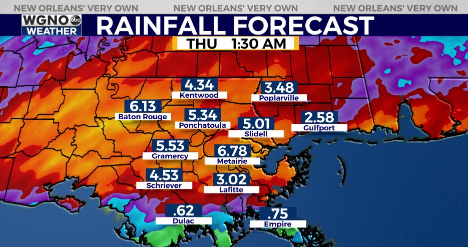
While it’s impossible to predict exactly where the heaviest rain will drop, high res guidance locking in on potential for 2-5+” of rain likely Tuesday-Tuesday night with localized higher amounts likely.
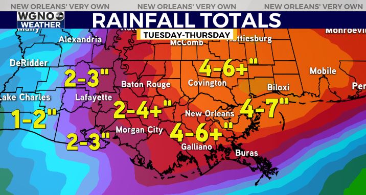
Over the next 3 days, 4-6″ rainfall amounts appear likely for SE LA with localized 6-8+” amounts possible. It won’t rain non-stop, and there will be breaks. Hopefully it comes in rounds/waves to mitigate flash flood issues.
In addition, a low-end Marginal Risk(Level 1 out of 5) for a few strong thunderstorms. Main risk of gusty winds, hail, & isolated tornado risk.
Timeframe appears tricky with intermittent periods of rainfall possible starting Tuesday morning. The flash flood risk looks to ramp up late Tuesday-Tuesday night through Wednesday night.
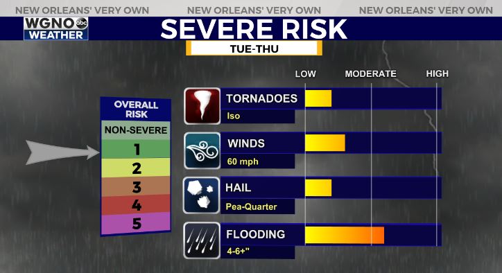
By Thursday, forecast models diverge on the details. Some models showcase the rain risk & severe risk staying further north. Still giving a 50-60% chance of thunderstorms, with a Slight Risk(Level 2 out of 5) risk for severe weather as well. Main risk of gusty winds & isolated tornado threat.
Stay tuned as we get closer!


