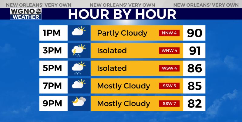
Another hot afternoon is on the way as temperatures warm back into the low to mid 90s and heat index values climb above 100. It does look like we should see some spotty storms develop by mid afternoon. These will be isolated but will also have the chance to be strong with gusty winds and locally heavy downpours.
Since the storms won’t move much the heavier activity could lead to localized street flooding. Expect any development to end by sunset and then we will look for mostly dry conditions over the next couple of days.
We are still watching the Gulf for the development of a tropical system.
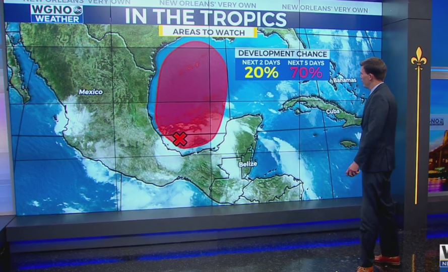
The Hurricane Center now has a 70% chance of development within the next 5 days. Right now it still looks like we would be dealing with a weak system with heavy rain being the main threat. There are still questions as to where the heaviest rain will fall, but several inches may fall heading into the weekend.
Stay tuned over the next few days.