The tropical system in the Gulf is finally showing signs of organization this morning. Clouds are trying to wrap around a broad area of low pressure and we could be in the beginning stage of seeing a tropical depression develop.
The biggest question for us remains whether the center makes landfall near our area or further west. A landfall over us would actually keep the heaviest rain well east into the Mobile area. Further west we would have the chance for higher rainfall amounts.
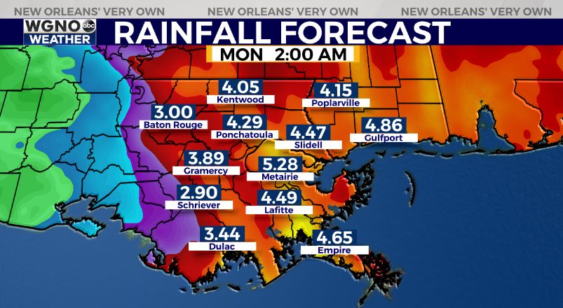
Right now on average it still looks like 3-6 inches of rain through Sunday with the higher amounts on the eastern side. That could shift either way though depending on the eventual track. Isolated tornadoes will be possible within the heavier rain bands. Coastal flooding should be minor. Again, a track farther east would mean less rain overall.
For today it actually feels decent out there thanks to lower humidity. Dewpoints are in the low to mid 60s behind a cold front that moved through yesterday. Look for plenty of sun today with low 90s. After that tropical showers will start to move in later tonight and tomorrow.