Once again, this was a stunning, perfect forecast for your Wednesday across southeast Louisiana and New Orleans, itself.
Yesterday, we were dealing with improved outlooks, too, especially in comparison on last week. Tough to stay inside in these gorgeous conditions with sunshine galore. Highs by your afternoon after lunch reached the 60s area-wide. Expect more of the same tomorrow!
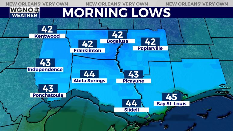
Anticipate an overall pleasant night tonight, as well. It will be chillier than anything these last few nights with temperatures falling into the low 40s north of Lake Pontchartrain and low 50s south!
Overall, this is a pretty nice set up throughout Zurich Classic weekend, especially Thursday and Sunday!

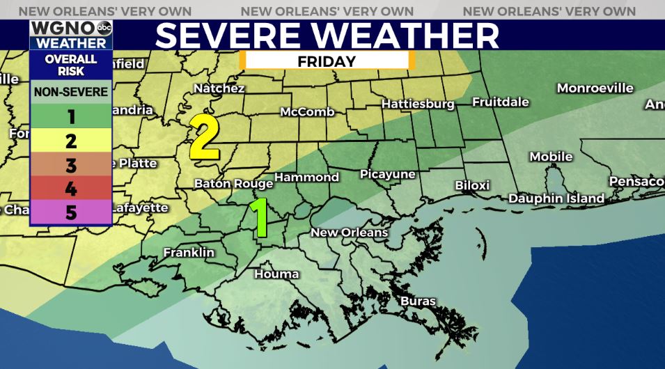
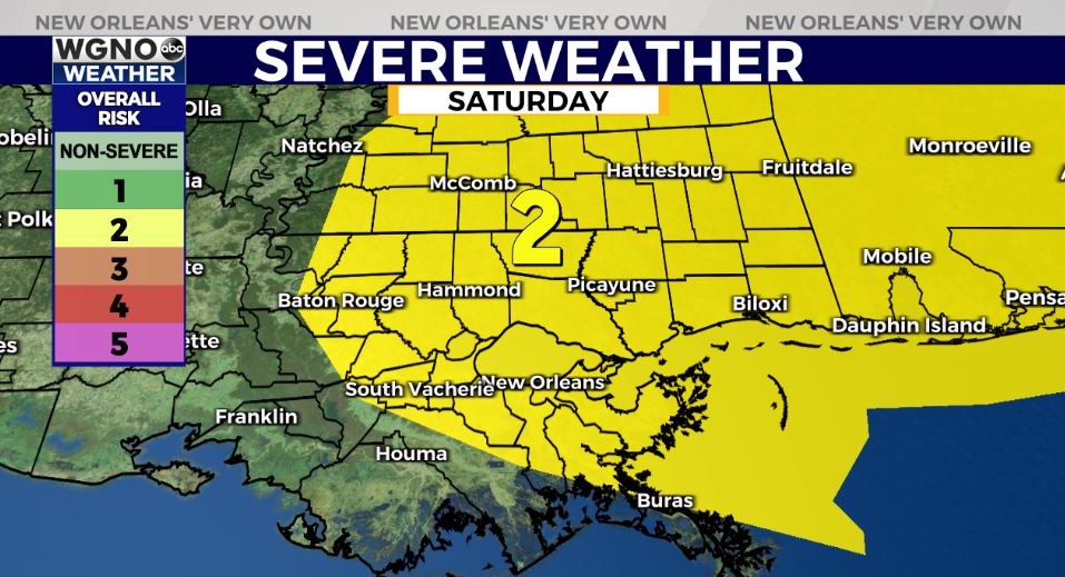
Friday, storms return and there’s the growing possibility of severe weather. Anticipate an increase in rain chances late, especially north. These stick around through early Saturday morning with improvements by Sunday! Right now, the Storm Prediction Center is issuing a Slight Risks primarily north (Level 2 out of 5) late Friday, then expanding it east early Saturday. All forms of severe weather look possible, so stay tuned as we iron out details.
No total washouts, so some good news there! Keep up, updates remain available online on WGNO.com and tomorrow during Good Morning New Orleans!
Check out current conditions near you: https://digital-stage.wgno.com/weather/new-orleans-weather-radar/
Stay up to date with the latest forecast: digital-stage.wgno.com/weather/forecast/
Download the WGNO Weather App to stay connected this hurricane season


