Overall, this was a gorgeous forecast for the first day of your week across southeast Louisiana and New Orleans, itself.
Yesterday, we were dealing with improved outlooks, too, especially in comparison on late Friday to early Saturday. Now, it’s tough to stay inside in these gorgeous conditions with sunshine galore and a few clouds each afternoon.
Highs by your afternoon after lunch reached the 80s area-wide. Tonight, we are slightly warmer than we were at this same time 24 hours ago throughout much of southeast Louisiana.
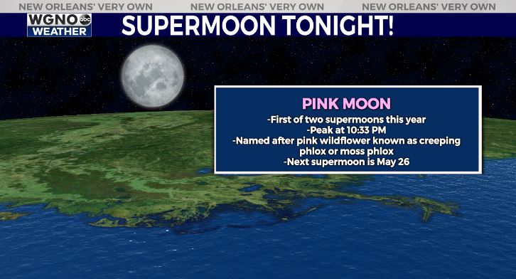
Anticipate an overall pleasant night tonight continuing. It will be a warmer than anything these last few nights with temperatures falling into only the 60s north of Lake Pontchartrain and 60s-70s south! Look up, too, to see the Pink Supermoon, which peaked at 10:33PM Central. Skies will be mostly clear at that point before clouds return before Tuesday.
Late week, we have another front on its way to town, which means an increase in rain chances. Friday, storms return but the theme continues being Spring-like weather.
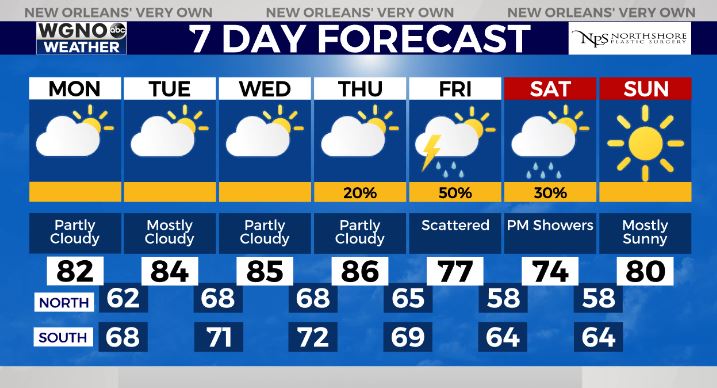
These stick around through late Saturday with improvements by Sunday! No total washouts, so some good news there! Keep up, updates remain available online on WGNO.com and tonight during Good Morning New Orleans!
Check out current conditions near you: https://digital-stage.wgno.com/weather/new-orleans-weather-radar/
Stay up to date with the latest forecast: digital-stage.wgno.com/weather/forecast/
Download the WGNO Weather App to stay connected this hurricane season