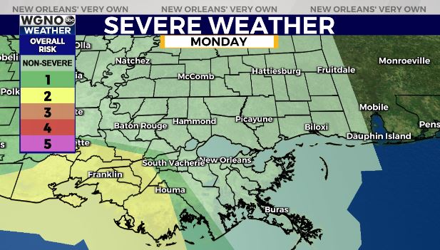
Later tonight to early Wednesday, there’s the chance for storms, and several could become severe. Right now, Storm Preditction Center is issuing a Slight Risk (Level 2/5) for much of southern Louisiana.
All of this is primarily west of WGNO’s viewing area with higher level risks throughout central Louisiana and along the coast!
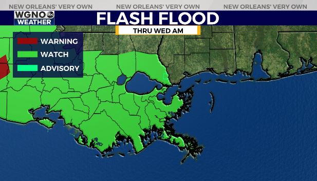
A Flash Flood Watch is issued through Wednesday morning as the primary concern will be heavy rain, which could lead to localized street flooding. Gusty winds are a concern, as well.
Neutral parking restrictions have been lifted through 6PM Tuesday, so move vehicles off of streets if possible to avoid rising water.
Afternoon highs were, area-wide, reaching the upper 70s to low 80s. Overnight, over both Northshore and Southshore locations, expect similar conditions to last night. 60s on the Northshore but 60s-70s on the Southshore!
Through our upcoming weekend, we continue to see increasing humidity and rain chances. Right now, the Storm Prediction Center is issuing no risk levels here locally for severe potential.
Regardless, since the stormier weather sticks around through next weekend, have ways you can receive warning information on hand incase anything is issued!
Keep up, updates remain available online on WGNO.com and tonight during Good Morning New Orleans!


