11:30AM VIDEO FORECAST — Grab the umbrella! Localized heavy rain moving in.
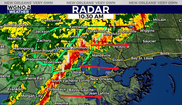
Areal flood advisory issued for large section of River Parishes & I-55 corridor. 2-3″ of rainfall reported. Watch for ponding of water on roadways! Rain will arrive across southshore within next 2 hours.
Colder, gloomy weekened. Even colder next week?
If you’ve been keeping up with the forecast, you know the forecast has been fickle, to say the least. Forecast models continue to show widely varying solutions with Louisiana’s forecast over the next 5-7 days. Here’s the deal:
High temperatures today in the upper 60s to the low-middle 70s in southeast Louisiana today, feeling like spring has sprung! But, big changes are on the way as a strong cold front arrives late Thursday-Thursday night.
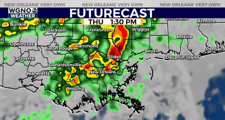
Higher rain chances will accompany the front Thursday-early Friday with 1-2″ of rain likely.
Colder air on the way in the wake of the front. The key? Forecast models have backed off on the potency of the cold air this weekend. It will still be chilly with highs in the upper 40s-lower 50s, but it overnight lows will stay above freezing on both sides of the lake.
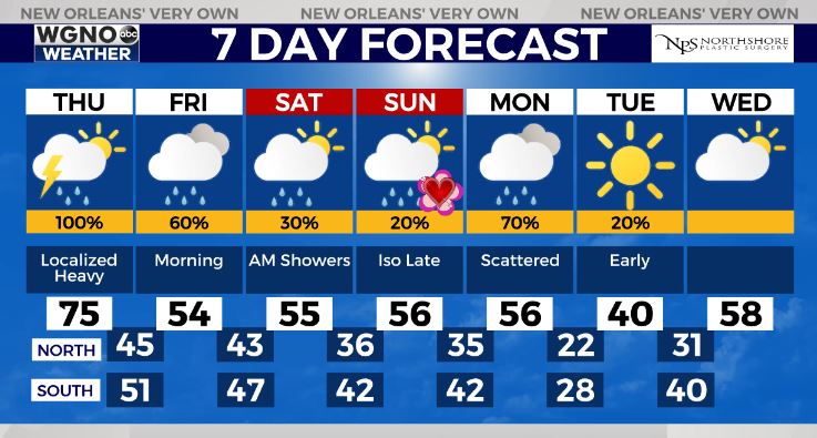
The coldest air looks to hold off until late Lundi Gras-Fat Tuesday. We will have to monitor potential for a moderate-hard freeze, especially north of the lake. Potentially the coldest Mardi Gras since 2011.
Right now, forecasted lows on Tuesday morning of 19-25 on the Northshore would mean full precautions of pipes, pets, plants, and people. Southshore of 26-33 would also mean light faucet drip for the pipes, especially away from the lake.
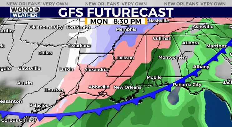
As far as wintry mischief, until the temperature forecast becomes more concrete, take any model guidance showing wintry precip with a BIG grain of salt. So far, the GFS has been trending too cold, EURO has been too warm. Usually, a blend between the two is a good bet.
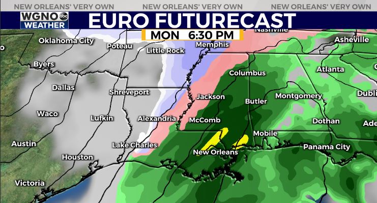
At this point, we look a little too warm for wintry mischief here on the southshore of southeast Louisiana, but for areas north and west of the lake…a period of sleet/freezing rain may be possible. This does not look like a snow setup.
It’s certainly worth watching the pattern into Lundi Gras-Fat Tuesday as things become more clear, especially in southeast Texas/northwest Louisiana. Stay tuned!


