Spring has finally moved in to the area and it looks like it is here to stay for a while. Temperatures will be well above normal across the area by the weekend.
Look for another cool morning Wednesday with lows around 40 to the north. It’s possible a couple of the cooler areas could drop briefly into the upper 30s.
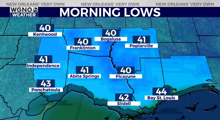
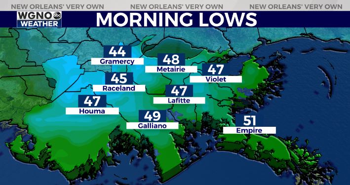
The south shore will be warmer with mid to upper 40s. Overnight temperatures will be quite a bit warmer through the rest of the week.
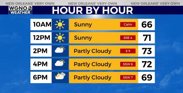
We will warm up quickly on Wednesday with plenty of sun through the morning. Look for highs to top out in the mid 70s. Cloud cover will build in by the afternoon.
A weak front moves into the northern areas on Thursday. This will mean the chance for a few light showers through the day and Thursday night. Best chance will be along and north of I-12.
Overall though rain amounts will be small and we will stay warm through the weekend.
Check out current conditions near you: digital-stage.wgno.com/weather/maps-and-radar/
Stay up to date with the latest forecast: digital-stage.wgno.com/weather/forecast/
Download the WGNO Weather App to stay connected this hurricane season