Rain is moving out of the area and that trend will continue tonight. However low cloud cover will stick around and be tough to clear out through the day Wednesday.
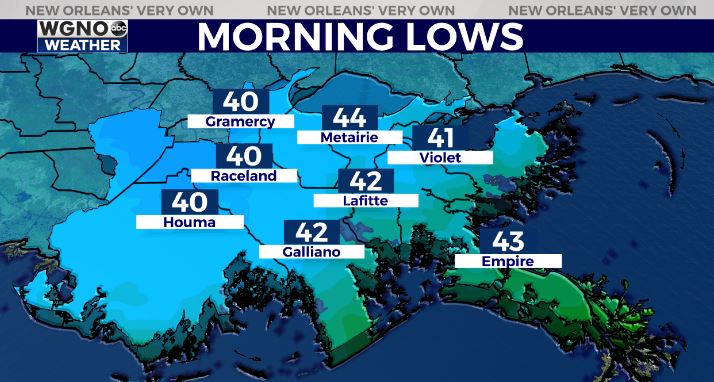
Look for a chilly morning to start your Wednesday though with upper 30s across most of the northern half.
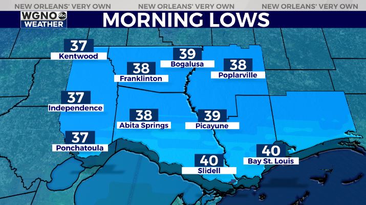
Lows will be dropping into the low 40s on the south shore. A few of the colder spots west of the lakes could still make the upper 30s briefly.
After that temperatures will be warmer through the afternoon but still below normal. Skies will continue to clear through the day Wednesday so look for low 60s with plenty of sun by the afternoon.
We will warm through the end of the week with mid to upper 60s on Thursday and Friday. Right now it still looks like a quick moving system will bring rain to the area briefly Friday night.
Check out current conditions near you: digital-stage.wgno.com/weather/maps-and-radar/
Stay up to date with the latest forecast: digital-stage.wgno.com/weather/forecast/
Download the WGNO Weather App to stay connected this hurricane season


