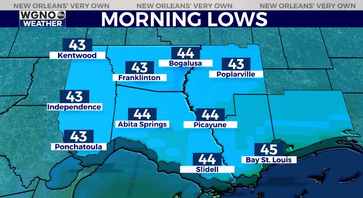
Temperatures will continue to drop heading into Friday morning. We are looking for mid 40s by tomorrow morning on the northern half of the area.
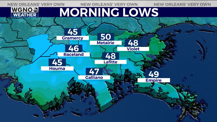
On the south shore look for upper 40s to around 50. The one thing that may hold the temperatures up would be cloud cover starting to drift in from the north. Otherwise look for a cool start to the day.
We don’t warm up that much by the afternoon time frame. Temperatures will stay well below normal with upper 50s to low 60s around the area through the day.

Look for another chilly morning Saturday with a nice weekend. Mid 60s for highs Saturday followed by upper 60s to near 70 on Sunday.
Check out current conditions near you: https://digital-stage.wgno.com/weather/new-orleans-weather-radar/
Stay up to date with the latest forecast: digital-stage.wgno.com/weather/forecast/
Download the WGNO Weather App to stay connected this hurricane season


