Winter will make a return later in the week after we see the warm and muggy conditions to start.
A cold front will remain over the area Monday night through Wednesday morning. This will keep the area in warm and muggy conditions.
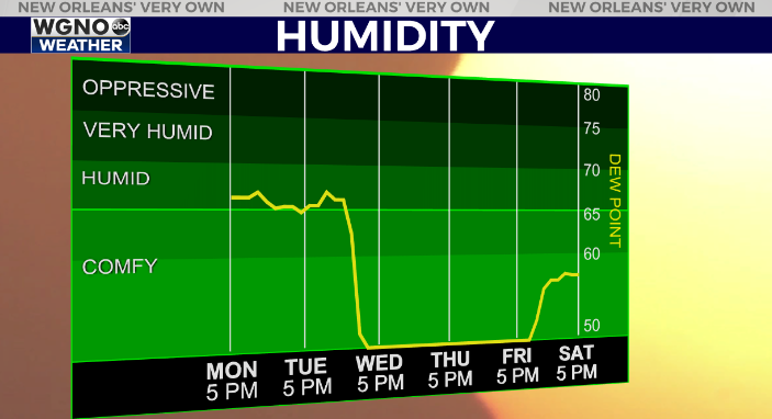
The humidity line shows the difference as the front moves through midday Wednesday. Warm and muggy weather will give way to cooler and drier conditions for Thursday and Friday. Look for windy conditions behind the front Wednesday afternoon as well.

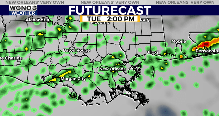
Rain chances will continue until the front moves through. However overall rainfall amounts will be light. Look for scattered showers tonight through Wednesday morning, but these will be spotty during this time frame.

After the front moves through highs will only reach into the mid 50s on Thursday with lows back into the 30s for Thursday and Friday mornings.
Check out current conditions near you: digital-stage.wgno.com/weather/maps-and-radar/
Stay up to date with the latest forecast: digital-stage.wgno.com/weather/forecast/
Download the WGNO Weather App to stay connected this hurricane season


