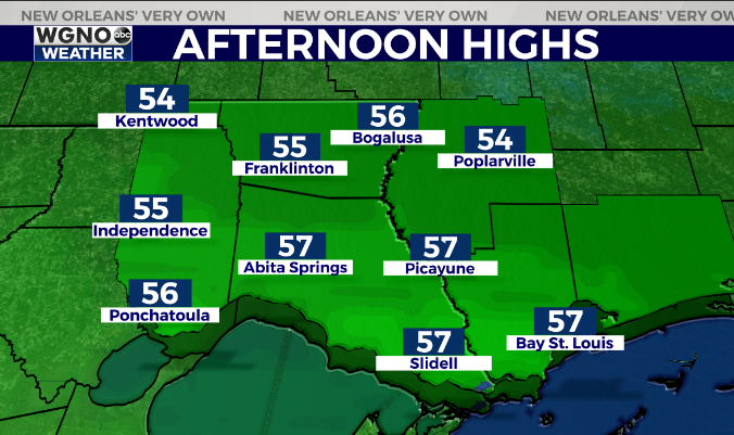
A cool weekend is on the way but at least it will be drier on Sunday. Look for a range of temperatures by Saturday afternoon as the front begins to lift inland by later in the day. Most likely it does get not all the way through the area so the northern half stays cool with mid 50s.
The south shore however will see low to mid 60s south of I-10 as that front moves north of those areas.

Expect scattered showers on Saturday but not as persistent as what we saw Friday. We will start to clear out Saturday night and stay cool with the upper 50s on Sunday.
Warmer temperatures start to move in early next week with highs back to near 70 on Tuesday.
Check out current conditions near you: https://digital-stage.wgno.com/weather/new-orleans-weather-radar/
Stay up to date with the latest forecast: digital-stage.wgno.com/weather/forecast/
Download the WGNO Weather App to stay connected this hurricane season


