Happy June! Once again, the forecast for today across New Orleans and southeast Louisiana was cool for early summer as a result of increasing humidity, clouds, and a few passing showers!
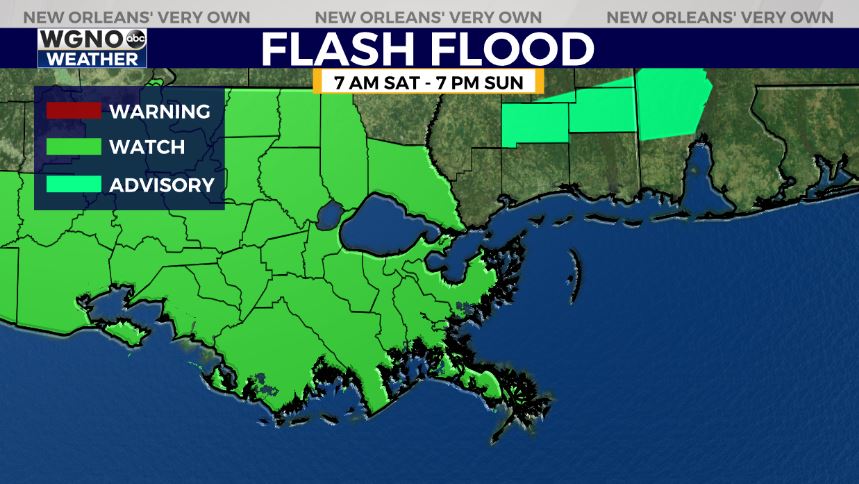
A Flood Watch does remain in effect for much of the WGNO viewing area from 7AM Saturday until 7PM Sunday based off of rain amounts that could be between 2-5 inches in total with localized higher amounts possible. Wind speeds have calmed down considerably, as well, across much of the area!
Afternoon highs were, area-wide, reaching the low to mid 80s. Overnight, over both Northshore and Southshore locations, expect 60s on the Northshore but 70s on the Southshore!
Late tonight to early Saturday, expect an increase in clouds and humidity. Rain chances look more impressive as our weekend progresses into next week! At that point, scattered showers cannot be ruled out with each day presenting about a 40% or 50% chance of storms.
Of course, this is going to mean temperatures rise into the upper 80s or low 90s! Typical for June!
Soak up these cooler temperatures while they last and keep up as more information on WGNO.com will be available the whole day today. Catch us live during WGNO News at 6 PM and 10PM Saturday in studio!


