11:30AM FORECAST — Very cold to Ash Wednesday. Risk for severe thunderstorms this evening. Here’s the details:
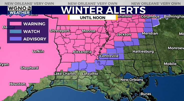
The winter that keeps on giving…another Winter Storm Warning issued for Northwest Louisiana. Unfortunately, this storm will bring freezing rain & sleet to places just impacted by Monday’s winter storm.
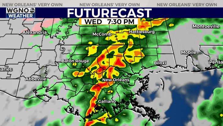
Meanwhile in southeast Louisiana within the “warm sector” of this approaching winter storm, we’re monitoring a severe weather threat late today into early tonight.
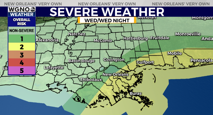
A Slight Risk(Level 2 out of 5) for severe thunderstorms. Main risk of damaging winds 45-60mph, large hail, & few isolated tornadoes. Timeframe for greatest severe risk looks to be between 5PM-9PM from west to east.
The key lacking ingredient for severe weather will be instability(heat & humidity) as temperatures will only rebound into the upper 50s/near 60 near New Orleans.
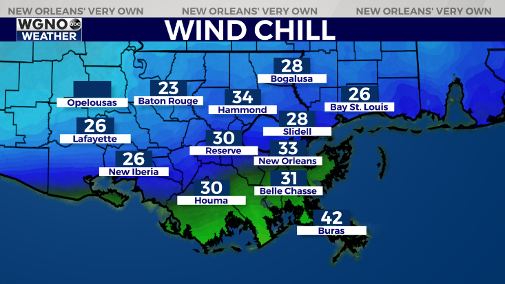
Behind the severe risk, much colder air will return. Another moderate to hard freeze expected north of the lake Thursday & Friday nights.


