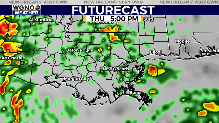
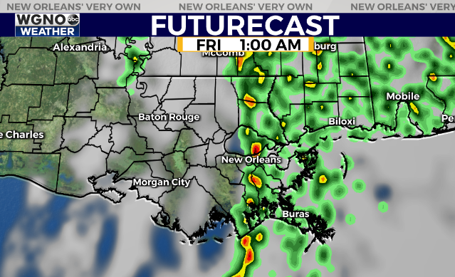
The Storm Prediction Center has issued a level 3 convective outlook for part of the area for Thursday and Thursday night. This indicates a higher than normal chance of severe weather occurring. The rest of the area remains in the level 2 zone.
Ingredients for severe weather continue to look likely on New Year’s Eve for much of southeastern Louisiana and southern Mississippi.
The forecast models have actually come into agreement of more intense activity moving across the area than what they were showing earlier in the week.
It looks like there will be two phases of severe weather. The first threat will be any isolated cells that develop ahead of the main line. With wind shear in place the stronger storms would likely contain rotation capable of strong winds and isolated tornadoes.

Right now the main line of storms looks to move across the area between midnight and 4 AM on Friday morning. This would be capable of damaging wind gusts and isolated tornadoes.

Please stay aware of weather conditions through New Year’s Eve and take action if any warnings are issued for your area.
Check out current conditions near you: https://digital-stage.wgno.com/weather/new-orleans-weather-radar/
Stay up to date with the latest forecast: digital-stage.wgno.com/weather/forecast/
Download the WGNO Weather App to stay connected this hurricane season


